Cherokee Hiking Club

Cherokee Hiking Club Calendar
2015
Hike Difficulty Rating Scale
(per Chattanooga Hiking Club)
Archive of past calendars 2005
2006 2007 2008
2009 2010
2011 2012
2013 2014
Check out the
Sequoyah Hiking
Club Activities
CHC Hike Calendar for 2015 - good for printing
Jan Feb Mar Apr May Jun Jul Aug Sep Oct Nov Dec
Tennessee Wild Hike/Backpack
Schedule
Benton MacKaye Trail Assn Hike
Schedule
1/7, Wednesday - Sequoyah Hiking Club Series of Hikes on the East Lakeshore Trail - The East Lakeshore Trail is on the north side of Tellico Lake to the west of US 411 near Vonore. The trail is about 25 miles long with parking areas about every 4-5 miles along the trail. We will be hiking each section from east to west each Wednesday over the several upcoming weeks. Today we will be hiking the Davis Ferry Branch Section from the Glendale Trailhead, about 6 miles out and back. The trail is well groomed and easy to hike with a few minor ups and downs. We will hike rain or shine, snow or sleet. We will be meeting at the parking lot of Las Fuentes Restaurant in Madisonville (just before Walmart on US 411 north of TN 68) at 8:45AM. We will work out our shuttle and leave the parking lot promptly at 9 AM. You do not need to sign up in advance, just show up with appropriate clothing and bring lunch and water. After the hike, we may go to a local eating establishment. This hike is open to anyone belonging to either hiking club and others as well. Dogs on leash are welcome. For more information, contact Rick Harris at 423-253-6358 or HarrisRi@aol.com. Information and maps of the trail can be found at http://www.tellicowater.org/trails.html.
1/11, Sunday - Annual Calendar Planning Meeting, 2PM, Family Resource Center, see newsletter for directions
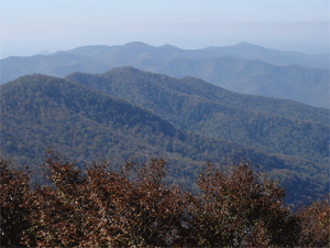
1/17, Saturday - Thunder Rock Hike - 3.5 miles, easy, leader Clayton Pannell. We will hike the Benton-MacKaye Trail (BMT) and the Thunder Rock Express, which is a nice hike for the winter time. We will meet at the Thunder Rock parking lot off Highway 64 at 9:00 a.m. We will do a car shuttle up Forest Road 45 to where the BMT crosses the road. We will hike south on the BMT to the Thunder Rock Express, and follow it back to the power house and the parking lot at the trail head. Anyone who wishes to do the BMT from the Thunder Rock campground to Forest Road 45 may do so at the start of or the end of the hike (strenuous). NOTE: this trail is a bike trail as well, and may have bicyclists on the trail. Please dress in layers for cold weather! Bring plenty of water too, since the winter dry air can dehydrate you as much as summer air. Let the hike leader know if you plan to go because we may need to reschedule, because of the weather condition. Contact Clayton Pannell at 423-263-9730 (home) or 423-435-1848 (cell) or by email at crpannell@comcast.net . Directions to the trailhead from Cleveland: take U.S. 64 east and cross over U.S. 411 at Ocoee. Continue on U.S. 64, passing the Parksville Lake/Lake Ocoee and dam on the right. Continue until you see the sign for the Thunder Rock Recreational Area on the right (if you pass the Ocoee Whitewater Center on the right you have gone too far). Take a right at the Thunder Rock sign and go over the bridge. You will see the campground and parking area there. You can also refer to the map at https://www.google.com/maps/place/Thunder+Rock+Recreation+Area/@35.0891421,- 84.5241536,14z/data=!4m2!3m1!1s0x0:0x476e9304a3f1fb18.
Hike Report: A bakers dozen (13) and one dog met at the Thunder Rock Trail Campground and parking lot at 9 a.m. on a cold and very clear day. After our greeting and sign-in we worked out our shuttle to where the Benton MacKaye Trail (BMT) crosses the U.S. Forest Road 45, about one mile from the campground. The whole group started the hike going south on the BMT from the shuttle location, to the Chestnut Mountain Loop Trail. A five-person group then split off from the main group. The latter, completing the originally-planned 3.5 mile hike, turned left on the Chestnut Mountain Loop Trail and then continued down this trail to the Thunder Rock Express. They turned down the T.R. Express, and came back out to a point on USFR 45 very near to the parking lot, then returned there and retrieved their cars from the shuttle location as needed. Most of this group stayed and had a picnic lunch at the T.R. Campground. Note to those who did not make this leg of the hike (or any part of the hike): the ”thunder rock” is still in the tree. The other group completed a 6-mile hike, which took them in the other direction down the Chestnut Mountain Loop Trail. From there they trekked around the Quartz Loop Trail and back to the Chestnut Mountain Loop. They saw several interesting views of Big and Little Frog, Starr Mountain and others of the higher peaks west of the GSMNP (Greater Smoky Mountain National Park). They then returned the way they came to the shuttle parking on USFR 45, and returned to the Thunder Rock Campground about 45 minutes or so after the main group returned there. Some of the 6-mile group stayed at the campgrounds and had a picnic lunch. The weather started warming to the mid-50's by mid-day, and the day stayed gorgeous. A good time was had by all! The picture below of our chilled group was taken at the outset of the hike, when the temperature was below freezing. Hikers included members Kathy Seymour and her faithful canine friend, Ruth and Clayton Pannell (hike leader), Evette Strickland, Jack and Margaret Callahan, Buddy Arnold, Randy Morris, James Anderson, Olga Cinnamon and Meetup guest Daryn. Pictures and relevant map of this event can be viewed at the club’s Meetup site at http://www.meetup.com/Cherokee-Hiking-Club-of-Southeast-Tennessee/photos/25860270/.
1/24, Saturday - 1/31, Saturday - Wilderness Wildlife Week at Pigeon Forge - go to http://www.mypigeonforge.com/events/wilderness-wildlife-week/ for information.
1/31, Saturday - Dry Pond Lead Trail (Benton MacKaye Trail) - 9 miles, Strenuous - Leader Randy Morris
We will hike part of Section 12 of the Benton-MacKaye Trail—commonly known as the Dry Pond Lead Trail— for a total mileage of approximately 9 miles. There is in excess of 1700 feet of elevation gain within the first 4 miles so I am rating this hike as strenuous. There are normally great winter views of Brock Mountain, the Ocoee Gorge and sometimes Big Frog Mountain on this trail which meanders along the NW boundary of the Little Frog Mountain Wilderness Area for much of the hike. Note: This hike will be canceled in the event of rain or snow on the morning of the event. We will meet in the parking lot behind Hardees in Ocoee at 8:30 a.m. for the trip up the gorge to the parking lot at Thunder Rock Campground. We will depart from the Campground parking lot just after 9:00 a.m. If interested in attending, please call Randy by Friday evening, January 30, at 650-0485 no later than 8:30 p.m. Contact Randy Morris for questions at 423-650-0485.
Hike Report: Four club members and one guest hiked approximately 9 miles on the Dry Pond Lead Trail, which borders the Little Frog Wilderness Area for much of its length, on a fantastic January day. The weather cooperated nicely, as after a chilly and overcast start we enjoyed a sunny day with great views of the western and eastern mountain ranges. These included Oswald Dome, Brock Mountain and Starr Mountain to the west, and Big Frog and the distant ranges in Georgia and North Carolina to the east. We ate lunch at the end of the Dry Pond Lead Trail on the flank of Little Frog Mountain, where the Benton MacKaye Trail separates and heads off around and down the mountain to Kimsey Highway. Lunch was pretty spectacular for some, as they enjoyed freshly-made and piping hot coffee or hot chocolate. Others took advantage of well-earned chocolate candy. Enjoying the hike and day were club members Buddy Arnold, Rick Foster, Randy Morris (hike leader), Evette Strickland, and Stephen Miller (guest) who we enjoyed getting to know. See pictures of this event at the club Meetup site: http://www.meetup.com/Cherokee-Hiking-Club-of-Southeast-Tennessee/photos/25888549/.
2/7, Saturday - Lula Lake Hike - variable, easy to moderate, Leader Rick Foster -
Leashed dogs are welcome. Easy to moderate, 2 to 3 miles or more, depending on your ambition. Leader: Rick Foster if you need a leader. 5000 Lula Lake Road, Lookout Mountain, Georgia. There may be a short car pool from the St. Elmo Bi-Lo, 3801 Tennessee Ave., Chattanooga, TN 37409 (going S, the second L fork off Broad St. after it starts to bend toward Lookout Mt., under the RR, L at light, L in parking lot & look for shabby red Focus hatchback). If you want to meet there please TELL ME by Friday 6 Feb NO LATER THAN 9PM: habitathound[at]gmail.com or (423) 536 [dash] 8353. Any other car pools must be arranged with someone else. http://lulalake.org/event/open-day-lula-lake-falls-3/ (map via the “Directions” link at bottom R).
2/8, Sunday - Hike from Ruby Falls to Sunset Rock on Lookout Mountain - 5-6 miles, moderate, Leader Rick Foster -
About 3 to 4 hours, with 4 flights of steps, (bathrooms at Point Park where they want you to pay the entry fee to use them). From near Ruby Falls we go around the north end of Lookout Mountain using the Upper Truck Trail to Rifle Pits Trail to Cravens House, switch back up the end of the mountain to Point Park, then take the Bluff Trail to Sunset Rock. The return trip takes Gum Spring Trail back to the Upper Truck Trail. Meet at the trailhead (by the gate & Bike Route sign) W through Ruby Falls’ main parking lot. Leashed dogs are welcome. We have a request for a car pool far this hike. Please contact me (habitathound[at]gmail.com or (423) 536 [dash] 8353) early Saturday to arrange. http://www.lib.utexas.edu/maps/national_parks/chickamauga_lookoutmt99.pdf
Hike Report: This spur of the moment hike was organized for the day after the Lula Lake Hike by Richard Foster as well. It was attended by Richard, and Jack and Margaret Callahan. The trail (or series of trails), like those of the Lula Lake Land Trust, also go along Lookout Mountain, but on the Tennessee side. The hike was rated moderate with a length of around 5-6 miles. It also featured about 4 flights of steps. The hikers started from a point near Ruby Falls, and went around the north end of Lookout Mountain using the Upper Truck Trail. They arrived at the Rifle Pits Trail (featuring the rifle pits constructed during the Civil War), and took that to the Cravens House, then made the switch back up the end of the mountain to Point Park. Then they took the Bluff Trail from there to Sunset Rock, the beautiful climax of the hike. The return trip took the hikers back to the Upper Truck Trail, via Gum Spring Trail. The following link shows a map of Lookout Mountain, its trails, and the historic Point Park and battlefield: http://www.lib.utexas.edu/maps/national_parks/chickamauga_lookoutmt99.pdf. Also, you can view pictures and commentary about this event on our club’s Meetup site at http://www.meetup.com/Cherokee-Hiking-Club-of-Southeast-Tennessee/photos/all_photos/?photoAlbumId=25908742.
2/12, Thursday - Monthly Meeting, 6PM, Golden Corral in Cleveland
2/21 Saturday - 2/22 Sunday - Pickett State Park hikes, Jordan Motel, Jamestown. Optional overnight stay at the Jordan Motel and eat at Bacara’s Family Restaurant (German), Jamestown. Ann Gray, leader.
2/28 Saturday - Carter Lake, GA Hike - leader James Anderson. 4.5 to 5 miles. Not hunting season this year.
Leader: James Anderson. Rating: easy to moderate. Length: 4.5 mile loop. The trail is a 4.5 mile loop with views of Carter Lake, between Chattsworth and Elijay. It also features a pretty water cascade. It is a relatively easy, and I think fairly new, trail and with little elevation change. Bring a lunch or a snack as we will stop for lunch along the trail. If weather gets rough or rainy, I may have to cancel, so please call to confirm whether the hike is on or not at 423-715-8824 (cell). Carpooling locations/departure times: The parking lot in front of the Cleveland Home Depot at 9:30 a.m. Directions: take I-75 to Exit 27 and turn east, going toward the new Cleveland Publix on Paul Huff Parkway (on the right). Continue past the next intersection after the Publix (corner of Mouse Creek Road). You will see the Home Depot back from the road on the left. Turn there and come to the parking lot in front of the Home Depot. Commuter parking lot behind the Hardee's in Ocoee at 10:00 a.m. Directions from Cleveland: take U.S. Highway 64 east out of Cleveland and continue until you reach the intersection with U.S. Highway 411. Take the exit ramp at the Ocoee McDonalds (on the right), and turn left, going north on 411. The Hardee’s will be a very short way down on the left. Turn in the driveway right after the Hardee’s parking lot, which leads to a commuter parking area in back of the Hardee’s parking lot itself
Hike Report: Today we
were able to make this hike happen. Neither
snow nor rain nor cold of day or night could
keep us from our appointed walk around the
lake. Thankfully hunting season is now
closed, which made this hike on the Amadahy
Trail undoable back in the fall. We had a
very pleasant walk in the snowy woods with
great views of the lake from much of the
trail. The trail was constructed fairly
recently by the Army Corps of Engineers near
Elijay, Georgia, in the Woodring Branch
Recreational Area around Carter’s Lake, and
doesn’t show up in some of the web searches
of Carter’s Lake trails because of this.
Here is a newer map which shows the trail:
http://www.sam.usace.army.mil/Portals/46/docs/recreation/carters/docs/AmadahyTr.pdf.
It consisted of a loop of around 4 miles in
length, and was an easy walk, in spite of
the snow and a few slippery patches. Toward
the end of the hike the sun came out and we
were able to enjoy our lunch in the sun as
we returned to our vehicles. Despite the
hike leader drinking beer throughout the
hike--root beer that is--the hike went off
today without a hitch. Those making the hike
included members Margaret and Jack Callahan,
Olga Cinnamon, Darrin Hunt, Becky Levings,
Evette Strickland, Ruth and Clayton Pannell,
Ann Gray and hike leader James Anderson.
Shown below is this hardy group, with James
Anderson taking the picture. As you can see
from the picture there was still a good bit
of snow on the ground. For more pictures
and comments, see
http://www.meetup.com/Cherokee-Hiking-Club-of-Southeast-Tennessee/photos/all_photos/?photoAlbumId=25947863.
2/28 Saturday - 3/1 Sunday - BMTA TN/NC Work Trip - Towee Creek Reroute -
The Towee Creek Reroute to bypass the crossing over Towee Creek on the John Muir section of the BMT is well on its way. Two switchbacks have been buillt along with some crib walls. Two more switchbacks are needed. Tread between the switchbacks has been at least roughed out, completed in places. We need all hands on deck to work on tread with hoe, pulaski and the like. Come join us for a two day work trip Saturday and Sunday, Feb 28-March1. There is room at my house for those who want to spend the night up here on Friday or Saturday night. Just let me know, though it will most likely be on the floor with sleeping bag and pad. We will meet at 9 AM on both Saturday and Sunday at the Towee Creek parking lot along the edge of the Hiwassee River. Mark your calendar and let me know if you plan on coming. Richard Harris, 513-260-1184 cell, HarrisRi@aol.com
3/7, Saturday - Cloudland Canyon Hike - leader Buddy Arnold. 8 miles with waterfalls, moderately strenuous.
Car pooling from Cleveland: Depart 9:00 am, Meet at Home Depot Lot . Arrive at Cloudland Canyon Park about 10:15. Directions if you go on your own, should take about 1 hour and 15 minutes (Note: there is a $5 entry fee per vehicle at the park) Take I-75 and I-24 through Chattanooga and then I-59 South toward Birmingham Take Exit 11 at Trenton, GA Go left over on SH 136 and continue 0.2 miles Turn right on Main Street and continue 0.1 miles Turn left on Lafayette Street (this is 136 East) Continue 6.6 miles to park entrance on left Continue about 0.2 mile to kiosk to pay fee Go past park store and gift shop and turn right at intersection (go toward Cabins 1-5) Go about 1.5 miles to parking area, restrooms, and trail head Start the hike going left at trail sign reading "Falls Trail". This will connect to West Rim Trail. Dogs are allowed if kept on a leash. The West Rim Trail is a loop trail with a total distance of about 5.5 miles with an elevation gain of about 300 feet overall. There is some up and down with the elevation difference from low point to high point of about 400 feet. I would rate it moderate due to distance and elevation changes. The trail has great vistas of the Canyon and views of Trenton, GA, and Lookout Valley 1200 feet below. There are nice overlooks along the way for a lunch or snack stop, or some may want to have their lunch at the falls if they decide to take that option as described below. When you get back to the parking area, I would recommend that you spend some time on the overlook trail. It is mostly flat and has great views of the canyon and you can see one of the falls described below. An option for those wanting some more strenuous hiking is to take another trail down to either Cherokee or Hemlock Falls or both. These falls are really spectacular being over 60 feet in height over a sheer cliff and some of the best in the region. About ½ mile into the West Rim Trail there is a series of steps and paths that go down the Canyon wall to view these falls. We will pass this junction on the hike out. On the return at about the 4.5 mile distance, there is an option to take the trail down to the fall or falls. Go down the trail about ¼ miles dropping in elevation about 150 feet and go left about 0.1 mile to get to Cherokee Falls. To get to Hemlock Falls, return the 0.1 mile and continue on down the trail about another 1/4 miles and drop another 250 feet in elevation to get to Hemlock Falls. Now the fun part is coming back out going up in elevation about 350 feet over 1/2 miles to return to the West Rim Trail. Going to both falls would add about another mile to the hike total and in the range of an hour to take time to view each fall and return or just 30 minutes or so if you hike to just the first fall. There is a trail (Sitton’s Gulch) of about 2 miles (mostly downhill with very nice walking along a creek) leading from Hemlock Falls to avoid going back up the Canyon wall. If you would like this option, we will need to leave a vehicle at the end of the Sitton’s Gulch Trail on the way into the park. The total length of this hike would then be about 7 miles. If you want to do this, let me know in your response, and we can plan for this. There are some shorter, less strenuous hikes starting at the same parking area. If someone would like to be a leader for a separate hike, let me know and I will provide some information on options. There are a number of other nice trails of varying difficulty in the park and vicinity and some may want to come and spend more time at the park with an overnight stay. There are cabins and yurt type structures, both reasonably priced. The phone number at the park is 706-657-4050 or for reservations 1-800-864-7275. You can get more information at GeorgiaStateParks.org.
Hike Report: This was a great hike with five club members participating: Buddy Arnold, Randy Morris, James Anderson, Jennifer Schroll and Chris Swain. The hike started about 10:15 a.m. in cool but sunny weather at the main parking area in Cloudland Canyon State Park on the Overlook Trail. The first part of the hike was about ½ mile or so on the Overlook Trail, with beautiful views of the canyon and two waterfalls on the opposite side. The hike then proceeded to the West Rim Trail, which is about 4.5 miles long. There were great views of Trenton and Lookout Valley along the trail. The group stopped at a nice sunny overlook for lunch around noon, about half way through this part of the hike with temperatures in the 50’s by then. With completion of the West Rim Trail, the hikers then started down the Waterfalls Trail, dropping about 400 feet in elevation via a series of steps and paths to view Cherokee and Hemlock waterfalls in the canyon. These are very impressive waterfalls, both falling over 60 feet off sheer cliffs. There were tremendous flows due to previous rain and snow, with ice formations at the falls due to very cold weather a few days prior to the hike. The picture above shows the group at Cherokee Falls. As we proceeded down the canyon wall to view Hemlock Falls, we had to navigate icy conditions resulting from melting and falling icicles along the canyon wall, as can be seen in the picture at left. The scene was very beautiful, but made us a little nervous as we occasionally saw ice falling and had slippery conditions. We then made it to Hemlock Falls, just as impressive as Cherokee Falls with even more ice formations. We got on the Sitton’s Gulch Trail and followed it along Bear Creek about 2 miles, where we had left a vehicle to ferry us back to the main part of the park. There were several more waterfalls viewed along the way, not as large as the other two, but still very impressive. Although only a few wildflowers were blooming this early in the year, it was evident that this is a good area for viewing wildflowers a little latter in the season. The hike ended about 3:30 with a total distance hiked of about 9 miles. More pictures of this hike are available at http://www.meetup.com/Cherokee-Hiking-Club-of-Southeast-Tennessee/photos/26014536/.
3/12, Thursday - Monthly Meeting, 6PM, Hiwassee-Ocoee State Park Visitor Center, pitch-in, Leon Bates will speak on wildflowers
The Cherokee Hiking Club will meet at the Hiwassee/ Ocoee State Park (Gee Creek) at 6:00 p.m. The meeting will be indoors in the Headquarters/Visitor Center across the road from the Park's Work Center. Please bring a covered dish to share, as well as a folding chair for each person in your party. Picnic tables are on location. Leon Bates will present a program on wild flowers. Since Leon is so knowledgeable about this subject, many people far and wide love to hear his presentations. Therefore we are allowing the park employees to attend if they so desire, since they have inquired about it. Directions to the Hiwassee/ Ocoee State Park: from Cleveland take U.S. Highway 64 east to the intersection with U.S. 411. At that point, turn north on U.S. 411, going through Benton. Continue north on 411, crossing the Hiwassee River; after crossing the river, take the second right, onto Spring Creek Road. This road leads to the Park. After crossing Gee Creek, the Headquarters/Visitor Center building and parking lot will be visible on the right.
3/14, Saturday - Tellico River Cleanup
Free food (if you work, that is)! Registration for this event begins at 8:00 a.m. in the Tellico Ranger Station. This event is sponsored by several groups, including TN Wild, the Gold Prospectors Association of America (GPAA), Tennessee Wildlife Resources Agency (TWRA), the Chattanooga Trout Association and more. The latter group is serving grilled hot dogs for all volunteers from 10:30 a.m. to 12:30 p.m. at the North River Checking Station on the Tellico River below Green Cove. TWRA will be serving homemade chili and offering tours of the Pheasant Field Fish Hatchery for volunteers. Wear long pants, sturdy shoes and gloves and a coat. This event will be happening rain or shine. See http://www.tnwild.org/events/tellico-river-cleanup/ for more information.
3/15, Sunday -
East Lakeshore Trail Hike - leader
Clayton Pannell - 3.5 miles, part of a 30
mile trail system. Note:
this hike has been changed from Saturday
March 14, to Sunday afternoon March 15.
This is after the time change to
daylight saving time. Located around
Vonore, the East Lakeshore trail is part
of a system that connects 30 miles of
trails. Please meet at the carpool
location in Etowah, TN, at the Bi-Lo
parking lot at
2:00 p.m. We will car pool to the
FIRST Sinking Creek Trailhead, on the
right of the Parkway. We will do an
in-and-out hike because there is a spot
that may be very muddy near the other
end of the trail.
Directions to the carpool location
from Cleveland: go to east down U.S. Highway 64 until it
crosses U.S. Highway 411, then head
north on U.S. 411, continuing north
through Benton and across the Hiwassee
River. Continue into Etowah. Staying on
U.S. 411, go through a few traffic
lights until you pass the turn to State
Road 30 on the left, and then you will
see the Bi-Lo grocery store on the
right. Park in the parking lot in front
of the store.
Hike Report: The weather was a relatively warm and sunny 70 degrees or so, on a Sunday afternoon. We carpooled from the Bi-Lo in Etowah and arrived at Tellico Lake, parking at the Sinking Creek trailhead and parking area. We hiked across the bridge and then walked a short distance down the road along the lake. The trail follows the lakeshore to the first fence crossing, which we climbed over on a set of wooden stairs. The trail then began a climb up and over a ridge, then across another fence and set of stairs, afterwards making a long descent to the lake and beach area. When we arrived at our destination, we found one bench, where we sat or stood around and viewed the lovely lake. There appeared no good way to get into the water at that point, for boating or swimming. We did not continue past that point because of the muddy areas caused by the recent rains. We returned the same way we hiked in; total miles were about 3.6. Our picture from this beautiful day is shown below. Eleven club members participated, including Ann Gray, Ruth and Clayton Pannell (hike leader), Rebecca Levings, Jack and Margaret Callahan, Me artha and Boyd Firestone, Darrin Hunt, Evette Strickland and Letha Kelly (taking the picture). For more pictures of this event, see http://www.meetup.com/Cherokee-Hiking-Club-of-Southeast-Tennessee/photos/26018999/.
3/21 Saturday - 3/22 Sunday - Benton MacKaye Trail Backpack from Beech Gap to TAPOCO Lodge - Leader Rick Harris.
This is a newly opened reroute of the BMT to avoid the Slickrock Creek crossing which can be dangerous in high water. This is an especially beautiful route with great views. Those going can stay at the Harris home on Friday night, then we will start the backpack Saturday AM. We will backpack from Beech Gap over Bob Bald, Stratton Bald, Naked Ground and the Hangover and will camp near the Hangover. Then on Sunday we will backpack out to TAPOCO Lodge. Contact Rick Harris to sign up at HarrisRi@aol.com or 423-253-6358 home, 513-260-1184 cell. About 8 miles on Saturday, 6 on Sunday.
3/21 Saturday - Day Hike to Bob Bald from Beech Gap - Leader Brenda Harris.
The backpackers will be on this hike as well. The dayhike is for those not wanting to backpack overnight. Moderate, 6-7 miles. Contact Brenda Harris at brendatharris@aol.com or 423-253-6358 home or 513-314-9717 cell.
Hike Report: 7 club members (including one canine member), 5 guests and one Meetup guest got a good workout on the Benton-MacKaye Trail, starting from the Unicoi Crest on the Cherohala Skyway to Bob Bald. Part of the going was fairly easy, starting out on a few hill-hugging switchbacks, across a newly built bridge across a washout. We then continued for a while on an old logging roadbed. At a crossroads, we headed up a steep ascent and then into a rhododendron thicket. The latter was extremely muddy due to recent rains, and we had to avoid sliding due to the slight uphill slant. We, like the BMT overnight backpackers led by Rick Harris, had the pleasure of meeting on the trail Tipi Walker, a well-known gentleman that regularly spends weeks alone hiking and camping in the wilderness and other remote areas. He was just returning from a 22-day backpack trip by his lonesome. He was an inspiration to us all. After 3.7 miles and 900 feet of elevation gain, we finally reached Bob Bald, where we ate our lunch and had a gorgeous view of the cloud cover, which we were above, at 5000+ feet. The weather was an invigorating and sunny 60-70 degrees when we reached the Bald, and we had the honor of being joined in our lunch with the hikers of the BMT overnight backpack trip to the Hangover , led by Brenda’s husband, Rick Harris (see the write-up on this event below). Being the day hikers, we returned after our lunch by the same route, for a total of 7.4 miles, while the backpackers went on to their camping destination at the Hangover. Our lively crew, just getting ready to start from the Unicoi Crest, is shown below. Hikers included members Darrin, Alicia and Daniel Hunt, hike leader Brenda Harris, Rebecca Levings, Evette Strickland and the irrepressible Jake Harris; guests included Russ Jones and 5 friends and neighbors of the hike leader. More pictures of this hike can be viewed at http://www.meetup.com/Cherokee-Hiking-Club-of-Southeast-Tennessee/photos/26000710/.
Mar 28-29 - BMTA TN/NC Work Trip on Towee Creek Reroute -
Due to deep snow, this work trip scheduled for Feb 28-Mar 1 has been rescheduled to the new dates, Mar 28-29. Meet at the Towee Creek Trailhead on the Hiwassee River Powerhouse Road at 9 AM ready to work on digging sidehill. Two switchbacks and trail between them are already done. We will be digging sidehill to the next two switchback locations. This reroute will bypass the crossing of Towee Creek which is dangerous in high water. Contact Rick Harris at 513-260-1184 cell, 423-253-6358 home or HarrisRi@aol.com to sign up.
Trip Report: Eleven backpackers traversed the new Slickrock Reroute of the Benton MacKaye Trail on this warm and sunny weekend - well, mostly sunny weekend. We started our trip at the Unicoi Crest Overlook on the Cherohala Skyway, just past the TN-NC state line. We hiked north to Cold Springs Gap on the old forest service road, and then we took the Bob Bald Access Trail for about a mile to the intersection with the Stratton Ridge Trail and from there up to Bob Bald after 3.75 miles and 900 feet of ascent. We ran into Tipi Walker as he was finishing up his 22 day backpack in the area and had a good talk with him. We made several brief stops to rest and to have introductions of each person, giving his or her background to the others. We also discussed various historical aspects of the trail area, such as the Stratton homestead, the Kirkland Bushwackers, the origin of balds, the spruce trees at the bald, and the slide on the Cherohala Skyway. At the Bob, we met the day hikers led by Brenda Harris (see write-up of the BMT Day Hike above) and joined them for lunch and the pretty views of the surrounding mountains. The day hikers then left to return to the Unicoi Crest Overlook. We continued on toward Naked Ground, where we rested and discussed the history of logging in the area and the Joyce Kilmer Memorial Forest. From there, we continued on up to Haoe and the Hangover with its 360 degree views of the Smokies and other mountains, valleys and lakes. We set up our camp near the Hangover, obtained water from the nearby spring, ate supper, and then spent some time out on the Hangover itself till bedtime. The trail overall the first day was in pretty good shape with only a few blowdowns and minimal brush, thanks to SAWS work trips this past year. On Sunday after breaking our camp, we headed down the Hangover Lead Trail toward Big Fat Gap. The first mile was steep and very difficult to traverse. This section definitely needs some help in the future with fresh sidehilling and possibly some short reroutes. The remainder of the trail to the gap was not too bad except for some very steep sections, especially near the gap. At the gap, two of our backpackers decided to finish the trip by hiking down the road, due to fatigue and knee/back problems. The rest of us continued on, getting water a short way down the Windy Gap Trail, then taking the very steep descent to the junction with the Nichols Cove Trail. We turned right and hiked through the cove with evidence of old homesteads and gravesites. There is not a distinct trail through here with several alternative routes. (We will need some way to establish a clear single route at a later time). We then intersected with the Yellowhammer Gap Trail, which looks fairly flat on the map, but is quite difficult due to the very frequent steep ups and downs and stream crossings. Much sidehilling and several blowdowns need removing on this section. When we reached Yellowhammer Gap, we then took the recently reopened Tapoco Lodge Trail down to Tapoco Lodge and our cars which we left there. It started to sprinkle on us as we headed down to the lodge. This 1.6 mile trail will need much sidehilling in the middle part, but the upper and lower parts are in good shape. At the lodge we all went to the grill underneath the main building for beer, iced tea, burgers, pizza and ice cream, keeping out of the serious rain which began to fall. We all left the lodge around 5 PM to complete our shuttle and head home. This reroute, once fixed up and signed, will be a great new stretch of the BMT. Three club members and eight guests went along for the adventure; the club members included Rick Harris (hike leader), Jack Callahan and James Anderson. Guests included some BMTA members and Meetup friends, including Jerry Schneider, Shirley Wright, and others. Our group picture at the starting out point is shown below. For more pictures, you can see this event at http://www.meetup.com/Cherokee-Hiking-Club-of-Southeast-Tennessee/photos/26014999/ .
4/4 Saturday - Shakerag Wildflower/Beckwith's Point Hike - 4.2 miles, moderately strenuous - Leaders Randy Morris & Leon Bates. 3-5 miles. Dates may change, depending on height of flower blooms.
We will hike a portion of the Perimeter Trail through beautiful Shakerag Hollow (one of the best wildflower hikes in the Southeast) and return via the Beckwith’s Point Trail after a short detour to Green’s View. Most of this hike is fairly easy, but we will have a short steep climb out of a gorge and some other up and down segments—after all we will be just off the edge of the western side of Monteagle Mountain on the beautiful campus of the University of the South at Sewanee. Also, portions are very rocky, so good hiking boots are recommended. Hopefully, we will catch the wildflowers in spectacular form, but it all depends on the weather conditions between now and then. Please call Leon Bates at 256-710-5508 no later than 8 p.m. Thursday, April 2 if interested in attending to find out the meeting location/time.
Hike Report:
On April 4, five Cherokee Hiking Club members (Rebecca Levings, Richard Foster, Jack and Margaret Callahan and Leon Bates, hike leader) hiked a four-mile section of the Shakerag Hollow/Beckwith’s Point trail on a brisk spring day. This trail is located within the University of the South at Sewanee’s 13,000 acres known as the “Domain”. More than 50 miles of trails of varying lengths traverse this diverse landscape. We hiked the eastern route via the Perimeter Trail to Beckwith’s Point and Green’s View, then descended the sandstone escarpment into Shakerag Hollow. A portion of this route follows an old trail constructed originally by the Civilian Conservation Corps (CCC) in the 1930’s and perhaps was preceded by earlier business owners known as “Moonshiners”. Descent into Shakerag Hollow was slow due to boulders and rock formations being wet following recent rains. Other visiting hikers expressed their preference for hiking “up” the boulders instead of “down”. Future CHC hikers may choose to hike the Shakerag Hollow route, then ascend to Green’s View. Shakerag Hollow is a natural cove hardwood forest with diverse wildflowers and large trees, some considered more than 200 years old. It is a botanical paradise because of lack of disturbance and site conditions. Numerous waterfalls and rushing streams add to the aesthetics and audible ambiance. This hike should definitely be added to your hiking bucket list. After return to the trailhead, your hike leader chose to hike the two-mile Piney Point trail overlooking Roark’s Cove. A panoramic view of the cove and surrounding escarpment from the rock formation was outstanding and recommended for our hikers. Portions of the Green’s Point cliffs and western Shakerag Hollow were visible on the opposite side of Roark’s Cove. Recommendations by Randy Morris and previous hikers were “spot on”; therefore, this location should be included for future hikes. Four of our hikers are shown below, at the point of the Perimeter Trail which borders the golf course. In the background is the beautiful view of the valley below, where the University lies. Pictured are hike leader Leon Bates, Rick Foster, Margaret Callahan and Jack Callahan. Taking the picture was Rebecca Levings. More pictures of this hike, including those of some of the beautiful wildflowers, waterfalls and rock formations, can be viewed at http://www.meetup.com/Cherokee-Hiking-Club-of-Southeast-Tennessee/photos/all_photos/?photoAlbumId=26028859.
4/9, Thursday - Monthly Meeting, 6PM, Sugarloaf Recreation Area below Parksville Ocoee #1 Dam, pitch-in. Bring folding chair and item for pitch-in.
4/10 Friday - 4/12 Sunday - Trails and Trilliums Weekend with Hikes, South Cumberland State Park - Leader Leon Bates. See www.trailsandtrilliums.org
4/11 Saturday - John Muir Trail/Benton MacKaye Trail Cleanup - Leader Debbie Flower and Clayton Pannell. 3-6 miles easy.
Meet at Childers Creek Trailhead at 9 AM. Bring helmet, gloves, eye protection if available, and bring tools such as clippers, saw, loppers. If you plan on attending, please contact the hike leaders by Friday evening, April 10th. Please contact Debbie Flower at 476-3907 or dndflower@bellsouth.net, or Clayton Pannell at 423-263-9730 or crpannell@comcast.net .
Hike Report:
It was a gorgeous day as nine members of the Cherokee Hiking Club cleaned up the three mile “Adopt a Trail” section of the John Muir Trail along the Hiwassee River. The trail was clipped and snipped. Rick Harris made quick use of his chain saw and cleared the trail of several massive blow-downs. We saw many wildflowers, including yellow trilliums, fire pinks, native mountain laurel, Indian corn flowers, violets, phlox, native azaleas and may-apples. There was very little trash, and sticks and brush were removed from the trail. Hikers are pictured below, and included Rebecca Levings, Rick Harris, Deborah Flower (hike leader), Dave Flower, Carol Guhne, Kathy Seymour with canine hiker Holly Blue, Clayton Pannell (hike leader), Letha Kelly and daughter Tina. More pictures of this event, including the wildflowers that we encountered, can be viewed at http://www.meetup.com/Cherokee-Hiking-Club-of-Southeast-Tennessee/photos/all_photos/?photoAlbumId=26051530.
4/18 Saturday - 4/19 Sunday - Ocowassee Festival at Gee Creek Campground with Hikes - Leader Leon Bates.
Celebrate the cultural, historical and recreational significance of this time of year. Try new things, meet new people and make some new memories! If it involves the outdoors,you can probably find it at the festival. A wide variety of adventures, activities and programs will be featured - from mushroom farming to beekeeping, tree climbing to backpacking, fire-starting to storytelling. This event will be taking place all day on both days at the Hiwassee/Ocoee State Park, 404 Spring Creek Road in Delano TN. To find out more, call the park office at 423-263-0050 or go to http://tnstateparks.com/parks/event_details/hiwassee-ocoee/2nd-annual-ocowassee-festival. Directions and a brochure can be found at that site as well.
4/21 Tuesday - 4/25 Saturday - GSMNP Spring Wildflower Pilgrimage, Gatlinburg - Leader Leon Bates. See www.springwildflowerpilgrimage.org.
Online Registration for the 2015 Spring Wildflower Pilgrimage began on Saturday, February 14th. Mark your calendars and make sure you get signed up for the programs that you want to attend before they are full, and make sure you reserve your lodging ASAP, the hotels, condos and cabins are going fast. The Club’s own native plant expert Leon Bates will be leading several hikes and talks for this event. You can download the beautiful brochure, featuring the event schedule and other information. Visit www.springwildflowerpilgrimage.org and click on "Download Brochure" to start your planning today.
4/25 Saturday - Cleveland State Community College Trail Cleanup - Leader Rebecca Levings. 2.5 miles.
This is our semi-annual cleanup at Cleveland’s Community College. We expect to do some light sawing, lopping and trimming, so just bring light tools such as bow saws, loppers, clippers and garden or work gloves. Wear long pants, since there is poison ivy in the area. Please also bring water and any snacks you will need. The CSCC doors will probably be locked on Saturday so it’s doubtful that vending machines will be available. Please arrive at 9:00 a.m. in the parking lot beside the tennis courts. Contact Rebecca by email at reblev155@aol.com or by phone at 423-310-0523 if you plan to attend or if you have any questions. Directions in Cleveland: go I-75 to Exit 27 and turn west on Paul Huff Parkway, toward Georgetown Road. Go past the mall with Target on the right, and turn left at the next traffic light after the mall, before you go up the hill; this is Adkisson Drive turning left (it’s Frontage if you turn right). Go past the Bradley County Driver’s License place on the left and you will come to Cleveland State CC down a little way. You will see the tennis courts on the right as you first get to the college. If you pass Norman Chapel road on the left (brown Baptist Student Union on the corner), you have gone a little too far. Turn in the parking lot beside the tennis courts and go all the way to the back.
Hike Report:
This event was canceled due to rain and potential thunderstorms. However, Carol Guhne showed up anyway around 10:00 a.m. after the rain had slacked off. After finding no one there, she proceeded to walk the trail anyway and picked up some trash. She found the trail in excellent condition, except she reported that there was somewhat of a washout toward the back, near the holding pond. The hike leader (Rebecca Levings) plans to check this out soon. There is some tread work that we will have to do on the trail at some point, plus installing some signage. Since the trail does not appear to need much brush work to be done at this point, it is safe to say that the regular trail maintenance will not need to be rescheduled until the fall.
5/2 Saturday - Big Frog Mtn via Chestnut Trail - Leader James Anderson, 8 miles strenuous
This hike will access Big Frog Mountain via the Chestnut Gap Trail #63 (also called the Chestnut Mountain Trail); not to be confused with the Chestnut Loop Trail of the Tanasi Trail System near the White Water Center. If you would like more information and/or are interested in attending, please contact James Anderson at 423-715-8824 (cell) or by email at james@fratn.com.
Hike Report: We had a nice warm day for the hike up Big Frog. There were nine people, including the hike leader. We took the Chestnut Mountain trail up, which is also known as the Hemp Top trail. It is not a heavily used trail but is the shortest and steepest route to the top. At the top we enjoyed lunch and met a backpacker from Mississippi who had been on the trail a couple of days. To avoid just doing an up-and-down hike, we decided to also hike out on the Big Creek trail. This trail goes off the western flank of the mountain, about a mile or so down the Big Frog Trail, which doubles as the Benton-MacKaye Trail in that area. It isn't maintained much, so the going was very slow. Fortunately, we didn't have any problem seeing where the trail went. Several of us agreed that if it were maintained, it would be a good trail up the mountain, as it is not very steep. This trail came out on the forest road where Big Creek crosses. Based upon our varying GPS trackers, we ended up walking between 9 and 9.9 miles. Along the way up we saw some blooming Mountain Laurel, and on the way down we saw several orange Flame Azaleas in full bloom. The walk along the creek at the end was also very nice. Although it was a long and sometimes slow day it was just good to be in the woods. We all made it out alive! Hikers included club members James Anderson (hike leader), Chris Swain, Buddy Arnold, Jack Callahan, Rick and Brenda Harris, and guests Mona, Patty, and Peggy. Our group shot below, from left to right, shows Chris, Jack, Mona, Patty, Rick, Buddy, Brenda, and Peggy. Not pictured is James, taking the picture. For more pictures of this fun event, see http://www.meetup.com/Cherokee-Hiking-Club-of-Southeast-Tennessee/photos/26111923/.
5/14, Thursday - Monthly Meeting, 6PM, Charleston Park in Charleston, pitch-in. You may also consider bringing a folding chair, as seating at the picnic tables is limited.
5/16 Saturday - Boyd Gap to the Ocoee Whitewater Center - Leader Ruth & Clayton Pannell, 5 miles moderate
We will start the hike by establishing a car shuttle at the White Water Center, then return to Boyd Gap. This hike will take us from Boyd Gap to the White Water Center. We will hike down Boyd Gap Trail (trail #331), experiencing a steep down-hill climb, and connect to the Old Copper Road Trail. We will then follow the Old Copper Road Trail to the White Water Center. After arriving at the White Water Center, we will utilize the car shuttle from the Center’s lower parking lot and return to Boyd Gap. Please meet in the lower parking lot of the White Water Center near Ocoee at 10:00 a.m. to set up the car shuttle, or if you are coming from points north, you can carpool with the hike leaders at the Etowah Bi/Lo parking lot at 9:00 a.m. Please plan to bring water, snacks or lunch. Bug spray might be a good idea now too, as the insect world is now active again around the river. If interested in attending, please contact Clayton and Ruth Pannell at crpannell@comcast.net, or at 423-263-9730 (home), 423-435-1848 (Clayton’s cell) or 423-506-9623 (Ruth’s cell).
Hike Report: Seven hikers came out on a day that the weather forecast called for rain. In spite of the rain forecast, we found a lot of activities happening on the trail. With the shuttle worked out, we drove to Boyd Gap to find an aid station set up for the 100 mile hikers that were coming through on the trail we were hiking. The 100 mile hikers were spread out and caused no problems. Next TVA was letting water out of the dam so folks could raft and kayak the upper-most part of the Ocoee River. However, the vegetation between the river and the trail was so thick, you could just barely see the river and rafters/kayakers in certain areas. Our hike took us from Boyd Gap to the White Water Center. We hiked down Boyd Gap Trail (trail #331), experiencing a steep down-hill climb, and connected to the Old Copper Road Trail. We then followed the Old Copper Road Trail to the White Water Center. The Old Copper Road had quite a few muddy spots, but we had no real problems getting around them. After arriving at the White Water Center, some of us ate lunch there, and we then took our shuttle vehicles back to our starting point at Boyd Gap. The Mountain Laurel was in full bloom along the trail, as you can see from the picture at left (thanks to Jack Callahan). We greatly enjoyed seeing it. More pictures from this hike can be viewed on the club’s Meetup site at http://www.meetup.com/Cherokee-Hiking-Club-of-Southeast-Tennessee/photos/26125184/. Hikers included club members Clayton and Ruth Pannell (hike leaders), Nathan Gafford, Jack and Margaret Callahan, and guests Carolyn Hyde and Mistie Clements. Thank you to those who came out to hike and the ones who helped with the car shuttle.
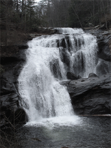
5/17 Sunday - Scenic Spur Hike - Leader Ruth & Clayton Pannell, 3 1/2 miles, easy
This is an “in and out” hike on the Scenic Spur Trail (#78), with two stream crossings. It is advisable to bring water shoes to wade the stream crossings. Please meet at the Scenic Spur trailhead at 2:45 p.m. or to carpool, meet at the Bi-Lo in Etowah at 2:00. Please bring snacks, water and any other gear you may need.
Hike Report: Four hikers came out on Sunday with another forecast of rain, to hike the Scenic Spur Trail to the waterfalls. We saw many wild flowers. Some of us did not know the names of many of them, but Margaret Callahan, being a budding wildflower expert, was able to identify several. The trail was in very good condition with only a few muddy spots; there were rocks placed in the creek to aid in the two creek crossings. The waterfalls were easily visible and very nice, as can be seen in the picture of one of them at right (thanks to Jack Callahan). There were quite a few hikers on the trail, and we encountered one couple with their young child, from Dallas TX. More pictures from this event can be viewed at http://www.meetup.com/Cherokee-Hiking-Club-of-Southeast-Tennessee/photos/26131063/. Hiker included club members Clayton and Ruth Pannell (hike leaders) and Jack and Margaret Callahan. Thanks to all for leading and coming out on the second hike of the weekend.
5/31 Sunday - Rhododendron Trail - Leader Joanne Jackson, 3 miles roundtrip easy
This is a lovely, flat, short and easy trail, recently built along the Ocoee River. It extends from the Thunder Rock/Ocoee Powerhouse #3, follows the Ocoee, and comes out at the picnic area across the river, back of the Ocoee Whitewater Center. It is also handicap accessible. You can walk along the dense shade of the rhododendrons that grow along the river, viewing the rafters and kayakers floating by. As you arrive at the White Water Center, you can choose to take your shoes off and bound over the rocks in the Ocoee or walk across a beautiful section of board walk that crosses the river, connecting the trail with the White Water Center. We will meet at the Thunder Rock parking lot off Highway 64 at 2:00 on Sunday afternoon. If interested in attending, please contact either: · Joanne Jackson at 281-782-7503 (cell) or jjtxtn@yahoo.com · Rebecca Levings at reblev155@aol.com or 423-310-0523 (cell)
Hike Report: Nine dedicated hikers came out to enjoy the lovely Rhododendron Trail on a stormy Sunday afternoon. The skies threatened (and sometimes delivered) rain throughout the day, but it was spotty. So the hike was not cancelled; we brought our ponchos, umbrellas and water shoes, and sallied forth. The trail was busy, as others had the same idea, including a group of mountain bikers who passed us three times going back and forth. We could also hear the excited shouts of the kayakers and rafters happily risking their lives on the white water of the Ocoee nearby. The rhododendrons were just beginning to pop forth with their lovely pinkish white blooms, we saw a black snake (probably not poisonous) that crossed the trail ahead of us, heading down to the river, and saw what looked like bear scat close to the electrical station at the beginning of the trail. When we approached the White Water Center (minus the Pannells, who had to return a little earlier due to another engagement), the thunderclouds began to sound their loud report, and by the time we were crossing the metal bridge to the Center, a lightning bolt came close overhead. No one was in a hurry however, as we were discussing the development of the Center, the summer Olympics that were held there in 1996, and the “Disney rocks” that were created to augment the already plentiful number of rocks, in order to create little pools to splash around in at the side of the river, water gardens and other delightful landscape diversions right around the Center. The hike leader was worried she would have to report an electrocution to the club, so she was trying to herd the hikers to quickly gather under the overhang on the bottom deck of the Center. We were happy to hang out there for a half an hour or so, as the electrical storm passed quickly over us, and then the deluge started. At least we were no longer worried about being electrocuted, so we passed the time in pleasurable conversation, while helping ourselves to some of the yummy goodies sold in the gift shop and availing ourselves of the nice bathrooms there. After a little while, the rain let up, and we headed back down the trail to our starting point at the Thunder Rock Campground. All in all, we had a very relaxing time, the temperatures were lowered a little by the rain, and we all learned a lot about the development of the White Water Center, thanks to the Callahans, who were both involved with that project extensively. Six club members came along, including Clayton and Ruth Pannell, Jack and Margaret Callahan, Karen Young and hike leader Rebecca Levings. Three guests attended, including Lauren Long, Lawrence Gale and Carolyn Hyde, who joined the club that day. Our group is shown below; thanks to Jack Callahan for his handy dandy timed shot. More pictures of this event can be viewed at http://www.meetup.com/Cherokee-Hiking-Club-of-Southeast-Tennessee/photos/26164221/.l
6/6 Saturday - National Trails Day Events in Tellico Plains - Leader Rick Harris
Meet behind the Cherohala Skyway Visitor Center at 9 AM to chose between three hikes (Unicoi Turnpike Trail 3 miles; Bald River Falls Trail 9 miles; or Fall Branch Falls 3 miles). Breakfast and supper provided. T-shirt $5. Maintenance work trip also available, working on the John Muir Trail section of the BMT along the Hiwassee River. Short distance from road to worksite. Meet at the Quinn Springs campground shelter at 9 AM. Breakfast and supper provided. Free T-shirt. Wear long pants and boots.
6/18, Thursday - Monthly Meeting, 6PM, Michaels in Etowah
6/7 Sunday - 6/12 Friday - Camping Trip with Hikes at Apple Tree Campground, Topton NC - Leader Clayton Pannell
In the Appletree National Park Group Campground, we have a large parking area, and many places to pitch tents. There is a large fire pit, and we can bring firewood from home. The site also has a nice shelter with tables where we can cook, eat, etc. We have a bathroom on site and the bathhouse is nearby. The camp is near the Nantahala River with hiking trails by the camp. As of April 23, the Nantahala National Forest said that we could bring wood from Tennessee; if this changes the Pannells will let the campers know. We will plan our hikes and other activities after we get to the campground. There are many trails in the area, including the Bartram, the AT, and the Standing Indian trails. There is a bike trail known as the Mountains-to-the-Sea trail, and some campers may want to float the Nantahala River; they will need to make reservations ahead for this. This website from the U.S. Department of Agriculture Forest Service gives some information on this park: http://www.fs.usda.gov/recarea/nfsnc/null/recarea/?recid=48642&actid=79.
Trip report: We arrived at Appletree before 4:00 p.m. and entered the park and set up our tents. On our first night, the campers included ourselves (Clayton and Ruth Pannell), Otis and Teresa Pannell, and Carol and Carroll Guhne. We enjoyed the use of a nice shelter and large fire pit. Being cool, we gladly warmed to a great fire in the evenings and each morning throughout the week. Below is the day-by-day account of our Appletree excursions.
· Monday June 8: we ate a late breakfast. Eventually a forest service employee came to clean the bathrooms and check on the campers; we were the only campers in the campground. In fact, we had the campground to ourselves pretty much the whole week. The campground was in great shape. The next day, some other Cherokee Hiking Club members arrived to join us; these included Ann Gray, Karen Young, and Martha and Boyd Firestone. We all enjoyed a visit and lunch together. Johnny and Judy arrived after lunch. Later we hiked some on the Bartram trail along the Nantahala River, but it was over grown and in very bad shape. Just after dinner a storm came through with rain and wind; it rained most of the night, but fortunately we all stayed dry in our tents.
· Tuesday June 9: we had a wet start and a great breakfast with blueberry pancakes. Carol, Otis and Teresa took a bike ride down the Old River Road, on the other side of the river from the campground. It was very gravelly with mud holes. The other campers drove the road to see the waterfalls and take pictures. After lunch Clayton and Ruth tried to hike the Nature Trail, but it was also overgrown and we could not follow it. We walked to the gate and crossed Junaluska Road, trying to follow the Barthram Trail on that side of the road. While we were discussing which way the trail went, local resident Mr. Akridge stopped in his off-road vehicle to talk to us and gave us a ride (2.5 miles) to the top of what was the Bartram Trail Road. This road still forms part of the Bartram Trail, but the road itself has been renamed. This section of the trail was well blazed. Mr. Akridge lives on this road, and even showed us his place. He then drove us to where the water pipeline ends, after it winds 7 miles through the mountains from the power company. It was fun and interesting to talk to him. Otis, Johnny and Judy hiked the Appletree Trail, and reported the trail was in good shape but steep on the upper part.
· Wednesday June 10: we traveled the Wayah Road to Wayah Gap, ending up on the Appalachian Trail (AT). Hikers Otis, Johnny, Judy and Clayton hiked from Wayah Gap to Wayah Bald, 4.2 miles with a long and steep climb over a mountain. On the north side of the mountain was an area with most of the trees dead, but the annual growth was pretty dense. The Guhnes and Ruth started at Wayah Bald and hiked down until they met the other hikers. On the return trip from Wayah Bald, the group went out for dinner at Lake's End Café. The view of Nantahala Lake from their boat dock was beautiful. Some of us enjoyed playing games later.
· Thursday June 11: after a large breakfast, Otis, Judy and Johnny were dropped off at the Junaluska trailhead, to hike back to the camp. They were able to follow the Junaluska Trail and its many stream crossings for a ways, but it became so overgrown they could not follow it and had to use other trails to get back to camp. The hikers encountered two rain storms on the way back, and were completely wet when they got back to camp, unlike those who stayed in camp; these folks endured very little rain that day. Clayton, Ruth, Carol and Carroll hiked up the Appletree Trail to the Junaluska Trail, following it through a forest of large straight trees with many turkey signs and sounds. All week weenjoyed snapping photos of unusual and beautiful flora. On one evening, we realized that the fireflies were putting on a "mini-synchronous" show after dark. It was amazing. Lights from the fire and other sources would disrupt this show, which went on for about three consecutive nights.
· Friday June 12: Carol and Carroll packed up to go home early. In camp we had country ham, eggs, toast and more, for breakfast. Campers that arrived later that morning were Jack and Margaret Callahan, Joanne Jackson, and Sheri Stewart. Otis made a long hike by himself. Johnny, Judy, Jack and Margaret hiked on the Junaluska Trail. Clayton, Ruth, Joanne and Sheri hiked on the Appletree Trail. Later that evening, we played games and watched fireflies.
· Saturday June 13: after late breakfast, we drove to the Wayah Bald Observation Tower again and spent some time there. It is a very beautiful overlook. Then we hiked north on the AT. A quarter of a mile up the AT, we came to a trail that leads to a fairly new shelter, with campsites, a privy and all. We ate lunch there and rested for the hike back up to Wayah Bald. Hikers included Jack, Margaret, Joanne, Sheri, Otis, Ruth and Clayton. On the way back to camp we stopped along Old River Road to view the waterfalls along the Nantahala River, so that Sheri and Joanne could get their feet wet and take pictures.
· Sunday June 14: Sheri and Otis fixed a great breakfast. All the remaining campers packed up and left the campground by noon.
Clayton would like to thank all that came out to enjoy the camp and beautiful campgrounds, the hikes, scenery, food and campfire. It was like a week-long picnic. Thanks to Carol Guhne for the pictures from this event. More pictures of the Appletree Campout can be viewed on the club Meetup site: see http://www.meetup.com/Cherokee-Hiking-Club-of-Southeast-Tennessee/photos/26234873/.
6/27 Saturday - Fall Branch Falls Hike - Leader Brenda Harris, 3 miles moderate. Meet at the West Rattlesnake Parking Area on the Cherohala Skyway at 10:30 AM or at the Cherohala Skyway Visitor Center at 9:30 AM. CANCELLED DUE TO SEVERE WEATHER, RESCHEDULED FOR AUGUST 29
7/11 Saturday - Coker Creek Falls Trail - Leader Marc Bernatti, moderate 3.5 miles
The trail starts at the Coker Creek Falls parking lot, goes mostly downhill, following the creek and ending up at the Benton MacKaye/John Muir Trails near the Hiwassee River. At times, when hill hugging, the footing is difficult. A walking stick is highly recommended for these areas. Please also bring enough water and a snack, although the Welcome Center in Coker Creek should be open to purchase whatever you forgot to bring. Hopefully Mother Nature will be smiling on us, and we should have a pleasant hike. Kids and pets are welcome. Please meet at the Coker Creek Welcome Center/Post Office at 10:00 a.m. We’ll work out a shuttle arrangement and drop off a vehicle or vehicles at the bottom and take those drives back up to the parking lot to start our hike. The road near the bottom is very rough, so we need high clearance vehicles with good traction to get down and come back out.
Hike Report: “Go take a hike”, they said; “you'll love it”. We did and we did love it. July 11th’s scheduled hike to Coker Creek Falls was a joy; three of us thoroughly enjoyed that natural beauty. The day was partially sunny and the temperature was excellent for the hike along Coker Creek. Water in the Creek had cleared up; it was no longer muddy from the rains, but still flowing heavy. We encountered a few fallen trees across the trail, but they were easily crossed over. By the time we made it to the bridge, the campers who were there when we dropped off the shuttle car had packed up and departed. However, there were a couple of determined prospectors in the Creek seeking their fortune. Note: If someone decides to come hiking up here now, use Deet liberally. I omitted that and brought home 4 hitchhikers (a.k.a. ticks). Below left is shown our threesome, including Marc Bernatti, hike leader (center), club member Joanne Jackson (right) and guest Paul Stearns (left). Below right is shown the lovely Coker Creek Falls. See more pictures of this event at http://www.meetup.com/Cherokee-Hiking-Club-of-Southeast-Tennessee/photos/26300575/.
7/12 Sunday - Hiwassee River Float Trip - Leader Clayton Pannell, from Gee Cree Campground to Patty Bridge, meet at 2 PM at Gee Creek CG. Bring your own canoe/kayak or rent one from Hiwassee Outfitters or the Webb Store.
We will lead our semi-annual summertime float trip down the Hiwassee River from Gee Creek. Everyone is responsible for their own canoe or kayak, life jackets, paddles and other gear, along with water and snacks. Note: each person floating must wear a life jacket. We will meet at the Gee Creek Campground’s boat ramp in the Hiwassee/Ocoee State Park at 2:00 p.m. From there some of us will take a few vehicles to Patty Bridge to leave there for the car shuttle. After the shuttle is worked out the river water level should start to rise, and then we will all take a happy and relaxing float down the river to Patty Bridge. At the end of the float trip, we will shuttle those with remaining vehicles at the Gee Creek boat ramp back to pick up their vehicles. We will then return to Patty Bridge, and will load up our canoes and kayaks. If interested in attending, please contact Clayton Pannell at crpannell@comcast.net , home phone 423-263-9730 or cell 423-435-1848.
July 13, Monday - BMTA TN/NC Work Trip on Heart of Darkness -
BMTA Maintainers,
Sat, July 25 - TN/NC BMTA Work Trip - Whigg Meadow to Beech Gap
Our TN/NC BMTA Work Trip on Saturday, July 25 will be at a high elevation and with easy access off the Cherohala Skyway. We will be working on the section from Beech Gap to Whigg Meadow. The Whigg is one of the most beautiful spots in the region. If you have not been there, you should definitely plan on going. This section, especially the section which parallels the Skyway, gets overgrown easily since it follows an old forest service road for most of the way. We will need three chain saws and lots of gas powered brushcutters, swingblades and loppers. Here are the plans:
We will meet at 8 AM behind the Cherohala Skyway Visitor Center for carpooling, or at the Unicoi Crest Overlook on the Skyway, 0.3 miles into NC from the state line, at 9 AM. From the overlook parking area, we will break into our work groups. One group will go from Beech Gap to North River Road, one from Mud Gap to North River Road, and one from the Whigg to Mud Gap. Each section is about 1.5 miles long. Each group will have a certified chain sawyer and swamper, and brushcutter guys and gals. We should all finish about the same time, mid-afternoon.
Everyone needs to wear long pants and boots. Not required, but I suggest a long sleeved shirt for protection from the briars. Snake gaters are also not required but will protect your legs from cuts (and snakes). Bring a lunch with plenty of water (2 quarts minimum). We can provide helmets, eye protection and gloves if you don't have your own. Each group will have a radio which can communicate with the FS frequency for intercommunication and in the case of emergency.
Please let me know in advance if you are going at HarrisRi@aol.com or 423-253-6358 home, 513-260-1184 cell. Also let me know what tools you wish to use or will be bringing. We have a few extra brush cutters. If you have a brushcutter, we recommend you put on a 3 pronged steel blade. It works best in this sort of growth, but a standard string cutter works fairly well as well.
Rick Harris
Interim BMTA TN/NC Maintenance Director
8/1 Saturday - Whigg Meadow Hike - Leader Brenda Harris, 3.2 miles moderate, lunch on the Whigg and pick blueberries then eat and drink beer at the Outpost afterwards in Tellico Plains. Meet at Mud Gap at 10:30 AM off the Cherohala Skyway (mile 3.5 on the NC side) or at the Cherohala Skyway Visitor Center at 9:00 AM. This hike is part of the Tellico Wild Weekend events. Contact Brenda Harris at BrendaTHarris@aol.com for questions or to sign up.
This event is being cosponsored by Tennessee-Wild for their “Tellico Wild: Explore our Big Backyard” event for July-August. Join Jack Callahan of the Cherokee Hiking Club for a relatively easy to moderate 3.2 mile round trip hike from Mud Gap to the beautiful Whigg Meadow. This is a great hike for kids and families! We'll hike uphill from Mud Gap (4480') to the meadow (4960') for 1.7 miles on an old roadbed which is now the Benton MacKaye Trail picking wild blueberries and huckleberries along the way. When we reach the meadow, we will check out the old homesite, the spring, and the pond, then lie out on the top and eat lunch and enjoy the (hopefully) cool breeze and mountain views before heading back down to our cars. The elevation gain is ~500ft. Bring your lunch, plenty of water and a bag or bucket to collect your wild blueberries. This hike is rain or shine, so be prepared for inclement weather, and don't forget the sunscreen! Hikers will meet at the Cherohala Skyway Visitor Center in Tellico Plains at 9:00 a.m., and then carpool up the beautiful Cherohala Skyway to the trailhead. Afterwards, we may choose to eat and enjoy happy hour at the Outpost in Tellico Plains.
8/2 Sunday - Bald River Trail Hike - Leader Rick Harris, 9 miles moderate, lunch by a waterfall. Meet at the Cherohala Skyway Visitor Center at 9 AM. This hike is part of the Tellico Wild Weekend events. Contact Rick Harris at HarrisRi@aol.com for questions or to sign up.
8/11-13 Tues-Thurs - Meteor Shower Observation - Club members Margaret and Jack Callahan are going to go to Pickett State Park on these dates to try to observe the meteor shower; the state park has received a "dark night sky" designation due to the limited light pollution in the area. This is currently the only site so designated in Tennessee. Anyone who wants to join Margaret and Jack is welcome; they plan to rent a cabin. There are also some 35 campsites available, with water/electric, and hot showers. They may also do a day hike to the natural stone arches nearby. If anyone interested, please contact them at 423-284-7885 or Jackn1945@bellsouth.net.
Hike Report: On a recent camping trip to Pickett State Park, leaders Jack and Margaret Callahan and several club members met to do a day hike to the natural stone arches, and to Chariot Lodge in Big South Fork NRA. They also stayed up until about 2:00 a.m. each morning to observe the Perseid meteor shower, which peaked on these days. Pickett S.P. was recently named as a "dark sky location" due to limited light pollution in the area....it is the only such designated site in Tennessee. They were overjoyed to be able to see a large number of meteorites. The hike to the arches and other landmarks took 6.5 miles, with an elevation gain of 660 feet. This hike will be even more attractive when the fall color arrives. Besides the arches, there are many many huge rock cliffs and overhangs along the trail, which are spectacular.
8/13, Thursday - Monthly Meeting, 6PM, Golden Corral in Cleveland. 6PM The address is 350 Stuart Road in Cleveland; we will meet in the conference room in the back. Each attendee is responsible for his/her own tab and tip. All visitors are welcome!
8/15 Saturday - Hiwassee River Float Trip - Leader Clayton Pannell, from Gee Cree Campground to Patty Bridge, meet at 2 PM at Gee Creek CG
Meet at the boat ramp in the Gee Creek camp ground on the Hiwassee River at 2:00 p.m. Everyone is responsible for bringing (or renting) their own canoe or kayak, life jackets, paddles and other gear, along with water and snacks. Note: each person floating must wear a life jacket. We will take some vehicles to Patty Bridge to shuttle people, and then canoe or kayak back to the campground. The water in the river should start coming up near the time we get the shuttle worked out, so there will be enough water to float in. If interested in attending, please contact Clayton Pannell at crpannell@comcast.net, 423-263-9730 (home) or 423-435-1848 (cell).
Trip Report: Saturday afternoon, with an overcast sky and weather calling for a 50% chance of rain, 7 canoeists and 1 kayaker met at the boat ramp at Gee Creek Campground for a float down the Hiwassee River to Patty Bridge. We did not need a shuttle, as Boyd and Martha Firestone had agreed to pick us up at 5:30 p.m. at the Patty Bridge take-out. The river water started coming up about 3:00 p.m. and then we got underway. We had an overcast sky to keep the sun off of us, but not one drop of rain fell on us, making the trip very enjoyable! We thank the Firestones for their great effort and commitment to our canoe trip by hauling everyone, the canoes and kayak back to the campground. They used their truck, trailer, and SUV to get us all back. “Thank you very much!” from Clayton Pannell and everyone who attended. Attendees (hikers turned river rats) included: Clayton & Ruth Pannell (leaders), Rick and Brenda Harris, Leon Bates, Joanne Jackson, Steve Kidd and Mike Mathery. Clayton thanks all that came out to make this a great float trip.
8/29 Saturday - Fall Branch Falls Hike - Leader Brenda Harris, 3 miles moderate. Meet at the West Rattlesnake Parking Area on the Cherohala Skyway at 10:30 AM or at the Cherohala Skyway Visitor Center at 9:30 AM
We will hike 1.5 miles to the Falls, eat lunch and take pictures, and then hike the 1.5 miles back. Parts of the trail are strenuous and rocky. Hiking poles and sturdy hiking shoes are strongly recommended, but you may also want to bring water shoes to splash around in at the Falls. We will meet at the West Rattlesnake Parking Area on the Cherohala Skyway at 10:30 a.m. An optional carpool may be done, meeting at the Cherohala Visitor’s Center in Tellico Plains at an earlier time. If you are interested in attending, or need carpool or other information, please contact Brenda Harris at 423-253-6358 (home), 513-314-9717 (cell) or BrendaTHarris@aol.com.
Trip Report: Despite the steep descent to the falls and equally steep ascent from the falls, the slick rocks and roots, and the rock hopping, I believe a good time was had by all on our 3.0 mile round trip hike to the 70 ft. tall Falls Branch Falls. Hikers definitely felt a sense of accomplishment after the hike! Because it was a short hike, we were able to spend a longer time at the base of the falls, getting to know one another better, talking about our hikes and adventures past and upcoming, and having a leisurely lunch. Our canine club member Jake spent the time swimming, wading and looking for minnows. Some of us heard the call of the Tellico Grains baker, all the way from Tellico Plains, and had to go for pizza, sandwiches, coffee and beer and more socializing afterwards! Those in attendance included club members Brenda Harris (hike leader), Rick Harris, canine Jake Harris, Rebecca Levings, Jack and Margaret Callahan, Marty and son Cody Dobbs, and Carolyn Hyde. Guests included David Mintz and JoAnn Brumlie, Margaret Matteson, and Lawrence Gale. Our smiling pre-hike faces are shown below, except for Rebecca Levings, who was taking the picture. More pictures of the group, the beautiful falls and the charming Jake Harris can be seen at http://www.meetup.com/Cherokee-Hiking-Club-of-Southeast-Tennessee/photos/26375787/.
9/5 Saturday - Bald River Falls / Cow Camp Loop Hike - Leader Rick Harris, 4 miles moderate. Meet at the Bald River Falls Parking Area at 9 AM. Contact Rick Harris at HarrisRi@aol.com to sign up. TO BE RESCHEDULED TO A LATER DATE
9/12, Saturday - Monthly Meeting, 5PM, Hike around McCamy Lake at Chilhowee, then pitch-in dinner/meeting at 6PM at picnic area by the lake
Our meeting/potluck picnic will start at 6:00 in the picnic area of the Chilhowee Recreational area, between the parking lot and McKamy Lake. If you are interested in taking the hike to Benton Falls, meet in the Chilhowee Rec area parking lot near the sign-in area at 3:30 p.m. The hike to Benton Falls is 3 miles round trip, and is easy for most of the way. If you want to go down to the base of the Falls, bring some sturdy shoes and hiking poles as the descent is steep and slippery. For the picnic, please bring a covered dish. Drinks and paper/plastic utensils will be provided. Visitors are always welcome! Note: there is a $3 charge per vehicle to enter the recreational area.
Attendees included club members Jack Callahan (hike leader) and Buddy Arnold, and guests Stuart Johnson and Cliff R. On Day 1, we started at Carvers Gap around 2:30 p.m., and after climbing to Jane Bald (5800 feet in elevation), we took a side trip to Grassy Ridge (6200 feet in elevation)...a great site for a future campsite. We then hiked down the slope to Stan Murry Shelter, which we had all to ourselves. Mr. Murry was instrumental in keeping the trail on the balds, and there is a plaque in his honor on Big Hump Mountain. On Day 2 we hiked to the intersection of Overmountain Trail, and took a side trip down to the "barn" shelter, which is an old tobacco barn that will sleep up to 20 hikers. The site includes a privy with a great view, and a reliable spring. Leaving the "barn", we hiked up to the top of Little Hump and had lunch and enjoyed the views. From there we hiked down to Bradley Gap, and got water at the spring there in preparation for our dry campsite on Hump Mountain. The spring, while developed, was flowing very slowly, about 1/3 cup a minute. It took us over an hour to get sufficient water for the evening. We made camp on the top of Hump Mountain, which gave us some spectacular 360 degree views, especially to the east toward North Carolina; the mountains just kept going and going! On Day 3, we broke camp early and made the final 6+ miles to the parking lot at Mountain Harbor before noon. We had some terrific weather, with clear skies, and not too much wind on Hump Mountain. We had a very good group, and I believe everyone was pleased with the hike. A group picture is shown below. More pictures of the beautiful scenery we encountered can be seen at http://www.meetup.com/Cherokee-Hiking-Club-of-Southeast-Tennessee/photos/26417549/
We hope to take this hike this month; it has been postponed before because the trail was in the midst of being rerouted. If this reroute has been completed, we will go, so please stay tuned for an update as to time and meeting place. This hike traverses a section of the John Muir Trail that overlaps with a section of the Benton MacKaye Trail. The trailhead begins very near the end of the public road leading to the TVA Appalachia Power House near Reliance TN. This time of year, the rare wildflower named “Ruth’s Golden Aster” is often in bloom in a meadow right off this trail; we plan to catch the height of its bloom. Ruth Pannell has a great fondness for this flower, not only because it shares its name with her, but because it is so beautiful. For more information and for updates, please contact Ruth or Clayton Pannell at 423-263-9730 (home), 423-435-1848 (Clayton’s cell), or Ruth’s email at ruthm.pannell@yahoo.com.
Trip Report: Six club members & one guest showed up for a glorious early fall day, led by the indomitable Ruth Pannell. We hiked to the Narrows from the trailhead at the TVA Powerhouse, and there we reached the Holy Grail of flowering plants, Ruth's Golden Aster. This rare, lovely little yellow aster (shown at right) has a different leaf type than the other larger yellow asters that were in bloom along the path to the Narrows. The pathway, along the John Muir Trail and the Benton MacKaye Trail, was in decent shape for the most part; there were a number of switchbacks and a few thick and mushy low spots that only a snake would love. Your newsletter editor was able to get her rear end wet when she slipped and fell on a slick rock in one of these snake beds. The Narrows themselves consisted of a rock bed with large boulders that we got to clamber over to get to the small but pleasant little riverside beaches, where we ate our lunch. Ruth’s Golden Aster (not named after our hike leader, after all) was in bloom in the cracks of the rocks themselves, along with some other nice little scrubby flowering plants, and some round-shaped lichens. It wasn't too hot, and we were able to eat a very nice lunch by an upstream portion of the Hiwassee. Some of us got our feet wet in the very cold water. We encountered a major swarm of extremely hungry mosquitoes (the worst I have experienced since I left Florida) right before we reached the rocky Narrows, and on our return trip, but they left us alone when we were on the rocks. Our hiking group is shown below; included are guest Lauren Long, members Letha Kelly, Karen Young, James Anderson, Joanne Jackson and hike leader Ruth Pannell. Not visible is Rebecca Levings, taking the picture. Hopefully James Anderson, who went fishing afterward, was successful in catching some trout in the Hiwassee below the TVA Powerhouse. See more pictures of this event at http://www.meetup.com/Cherokee-Hiking-Club-of-Southeast-Tennessee/photos/26422116
We will begin our hike from the parking lot of the Byron Herbert Reece Access Trail located off of U.S. Highway 19 just north of Neels Gap. We will ascend up the lower reaches of Blood Mountain amid lush mountain laurel and rhododendron to a junction with the Appalachian Trail (AT) after about 0.6 miles. We will then turn west on the AT and follow the white-blazed AT to the summit of Blood Mountain at 4,461 feet (the highest peak on the AT in Georgia). This portion of the trail is very steep and rocky and is a workout for anyone, and not a good fit for the casual walker. We will gain nearly 1,500 feet of elevation by the time we reach the summit in only about 2.3 miles total (with most of the gain in the last 1.5 miles). After an early lunch at the summit enjoying the views, we will descend back down the AT to our junction with the access trail. I plan to add a couple of miles to the normal route of 4.3 miles and head on down the AT to Neels Gap and visit the Walasi-Yi Center. We will then backtrack up the AT to the junction with the access trail and take it down to our vehicles. We will carpool from the Ocoee Hardee’s, leaving at 7:30 a.m. sharp. We should be at the trailhead by 9:00. Those planning to attend the hike should contact Randy Morris at (423) 650-0485 no later than 8:00 p.m. Friday, September 25. Please bring a lunch, plenty of water and hiking poles. Wear sturdy hiking shoes or boots and bring a wind breaking layer of clothes as the heights of Blood Mountain may be a little windy or chilly at this time.
10/3 Saturday - Clear Creek Hike on Chilhowee Mtn - Leader James Anderson, 6 miles moderate
This is a newly announced camping trip, to be led by CHC prez Clayton Pannell. It will be held at the Big South Fork Bandy Creek National Park, located on the Cumberland Plateau in both Tennessee and Kentucky. Camping will be done at the group site there. There are many wonderful hiking trails in the vicinity, so these will be explored as well.. The dates are Sunday, October 4 through Thursday, October 8, 2015. Clayton has a group site reserved starting Sunday night the 4th. Camp will be broken on Thursday morning, October the 8th, so that people can return and come to the October club meeting that evening at the Whitewater Grill in Ocoee. Our reserved site has a screened-in shelter, its own shower house with hot water, and a fire ring. We may take in motor homes and camping trailers there. However, there is no electricity provided in the camping spots; only in the shower house and shelter.We have room for all who want to go on this trip.Here are some helpful websites related to Big South Fork National River & Recreation Area:
· Directions: http://www.nps.gov/biso/planyourvisit/upload/access.pdf and http://www.nps.gov/biso/planyourvisit/directions.htm
· Brochure: http://www.nps.gov/biso/planyourvisit/upload/brochuretext06.pdf
· More info: http://www.nps.gov/biso/planyourvisit/brochures.htm
· Home: http://www.nps.gov/biso/index.htmFor more information or to reserve a spot, contact: Clayton Pannell home 423-263-9730
Trip Report:
Sunday, October 4th: Otis Pannell and his wife Teresa, and Ruth and Clayton Pannell (leader) arrived at Big South Fork, Bandy Creek campground, and set up their tents in the group camping area E-2. E-2 is a large group camping area with about 18 sites, and its own bath house, screen-in shelter and fireplace. Our group had all these amenities to itself. We even had sinks on the porch outside the bathhouse that we used to wash our dishes. Otis and Teresa left the campground to buy firewood, and they came back with a van fully loaded with wood; one rack was all they could get into the van. Other hikers that joined us on Sunday afternoon included JoAnn Jackson, Sheri Stewart and Jane Bohannon.
Monday, October 5th: after a large breakfast and a great social time, the campers hiked to Angle Fall down the Big South Fork River 2.2 miles. The trail was in great shape, and we spent some time at the falls or rapids. Hikers on this trek included Clayton and Ruth Pannell, Otis and Teresa Pannell, JoAnn Jackson, Sheri Stewart and Jane Bohannon.
Tuesday, October 6th: after another large breakfast, we hiked up the Big South Fork River from Leather Wood Ford to the O & W Railroad Bridge. The bridge is a big attraction and is used by vehicles and hikers to cross the river. It is 2.3 miles from the trailhead at Leather Wood Ford, and the trail to the bridge is in good shape with some steps and sort climbs. The real test of the hikers occurred on the steep trail to what is known as the Devils Den, l6 miles almost all uphill with some very steep sections. Devils Den is a large open area under an overhang, a good place to get out of the rain. Hikers on this section included Clayton Pannell, Otis and Teresa Pannell, Johnny Lorris, JoAnn Jackson, Judy Pannell, and Jack and Margaret Callahan.
Wednesday, October 7: a group of six hikers hiked to the twin arches (as opposed to the Golden Arches), and they extended their hike from the arches to catch many views of the cliffs. This hike was about 4 miles in length, with lots of steps. Hikers included Jack and Margaret Callahan, Otis and Teresa Pannell, and Johnny and Judy Pannell. Other hikes that occurred on this day included a hike to a rock formation upstream from Leather Wood Ford; Ruth and Clayton Pannell and JoAnn Jackson went on this one. Afterwards they drove to Oscar Belvin’s old home place, and then back to the campground. Later in the day Clayton Pannell and his son Otis hiked the Brandy Creek Trail from the campground, for a total of 1.3 miles.
Thursday, October 8th: after another large breakfast, we packed up and started home before noon.
Clayton wishes to thank all the hikers, cooks and everyone who supplied food, drinks, and other supplies!
10/8, Thursday - Monthly Meeting, 6PM, Home of Bill and Ann Gray
Bill and Ann Gray have so gracefully volunteered their home in Cleveland for our October meeting. We plan to start the meeting first off at 6:00 p.m. Meanwhile Bill will go out and get the pizza so it will be nice and hot for the meal after the short meeting. The Club voted at the September meeting to pay for the pizza; the Grays will generously provide the desserts and drinks. The Gray home is located at 2349 Varnell Road, Cleveland, TN.
10/17 Saturday - 10/18 Sunday - Benton MacKaye Trail Backpack from TAPOCO Lodge to Fontana Dam - Leader Rick Harris
We have a backpack scheduled on the BMT from Tapoco Lodge to Fontana Dam Oct 17-18, a section about 14.5 miles long, traversing the Yellow Creek Mountain Section of the BMT, which is the original route of the AT. This is a fairly difficult backpack due to the elevation gain and the PUDs (pointless ups and downs). And water may be iffy, so we may have to carry water some distance to our campsite. But such is life.
Plans are to meet at the Fontana Dam parking lot on Saturday at 9 AM, leave what cars we need to leave there, then carpool back to Tapoco Lodge on US 129 near Cheoah Dam. From there we will backpack up Yellow Creek Mountain to camp probably near the powerline crossing. We may need to carry water to our campsite from back a ways on the trail, depending on the water situation when we leave on the trip. So be prepared to haul extra water some distance, probably about 1.5 miles. On Sunday morning we will backpack to the lodge at Fontana Village, then on to the intersection with the AT and out to the south end of Fontana Dam. We will then retrieve our cars at Tapoco Lodge and possibly eat dinner there in their grill (pizza, beer, etc) before heading home.
This is a recently opened section of the BMT after rerouting the trail off US 129 (Tail of the Dragon). Points of interest include Tapoco Lodge itself, the old AT route up Yellow Creek Mountain, a few nice overlooks including Lookout Rock above Fontana Village, Fontana Village itself, and Fontana Lake and Dam. Also you will get to see our newly installed routed wood trail signs along this section, thanks to Dick Evans and the Nantahala National Forest folks as well as an anonymous donor who paid for the signs.
As on the last backpack, all are welcome to spend the Friday night at my house, though be prepared to possibly sleep on the floor with your pad and sleeping bag.
If interested in joining us, please let me know at HarrisRi@aol.com or 423-253-6358 (home) or 513-260-1184 (cell).
Rick Harris
TN/NC Representative, BMTATrip Report: See the newsletter for pictures and a full report
We will meet at the Childers’ Creek Trail Head at 9:00 a.m. The hike is a beautiful, easy 3 mile trail along the Hiwassee River. It can be either a 3 mile or a 6 mile hike depending on time and car shuttle. Please bring gloves, your choice of lightweight tools (clippers, light saw, loppers), water and a snack. Trash bags will be provided.
Trip Report: Our fall clean-up of this trail found the weather fairly overcast. The good news was that we came across very little trash, and the trail was in very good shape. The only work the participants had to perform was some lopping along the trail. Attendees included Clayton (leader) and Ruth Pannell, and Clayton’s son Otis Pannell. Man/hours worked were 9 and man/hours travelled were 4.5.
11/7 Saturday - Graysville Mtn Section of the Cumberland Trail - Leader Randy Morris, 8 miles moderate along Roaring Creek - CANCELLED DUE TO BAD WEATHER
We will hike on the Graysville Mountain Section of the Cumberland Trail near Graysville, TN. Approximately one-half of the hike will be on relatively new trail created by recent Spring Break work trips coordinated by the Cumberland Trail Conference. The hike begins along beautiful Roaring Creek, and then climbs up the mountain with an elevation gain of about 900 feet. We will proceed to enjoy the views from a nice overlook before traversing some of the newer trail on to two additional overlooks. We will then eat lunch at the second, Cove Loop Overlook, and then re-trace our steps back the way we came. I am rating this hike as moderately strenuous to strenuous because of the climb up the mountain and length. A great description of the first 1.8 miles and a map of the entire hike can be found at:http://cumberlandtrail.org/website/maps-and-guides/trail-segments/graysville-mountain/.
11/12 Thursday - Monthly Meeting, 6PM, Monterrey Mexican Restaurant in Cleveland
11/14 Saturday - Cleveland State Community College Trail Cleanup - Leader Rebecca Levings
This is our semi-annual cleanup at Cleveland’s Community College. We expect to do some light sawing, lopping and trimming, so just bring light tools such as bow saws, loppers, clippers and garden or work gloves. Wear long pants, since there is poison ivy in the area. Please also bring water and any snacks you will need. The CSCC doors will probably be locked on Saturday so it’s doubtful that vending machines will be available. Please arrive at 9:00 a.m. in the parking lot beside the tennis courts. Contact Rebecca by email at reblev155@aol.com or by phone at 423-310-0523 if you plan to attend or if you have any questions.
Hike Report: Seven club members and two guests showed up on a cool and slightly overcast, but pleasant November morning. Using light tools, we cleaned off the trails of the Cleveland State Community College trail system, clearing out the 3 loops of the trail. Except for two downed trees, the trails only needed a light clearing, sufficient to keep the trails clear until the spring overgrowth season arrives. Richard Foster industriously began to saw up the smaller downed tree across the northern loop, using a small folding saw. James Anderson and Frank Pack assisted him with their bow saws. After about 45 minutes, the tree, which was somewhat rotted already, was cleared off the trail. There was another larger tree, more freshly fallen and not rotten, hanging across one of the southern trail loops. Rick Harris, who couldn’t make it today, will return with his chain saw within the next couple of weeks to remove that tree. In all, we had a productive trail maintenance session that took us less time due to the number of folks who helped. Rebecca Levings, hike leader, wishes to thank James Anderson, Clayton and Ruth Pannell, Ruth’s son, Carroll and Carol Guhne, Richard Foster and Frank Pack for all their hard work on the maintenance today.
11/21 Saturday - While Oak Mtn Trail Hike near Collegedale - Leader Chris Swain, 3 miles
This trail is near Collegedale, with a 300 feet of elevation gain. Please meet at the Home Depot parking lot at 546 Paul Huff Parkway in Cleveland at 9:00 a.m. to carpool to the trailhead. Directions to carpool location: take I-75 to Exit 27, and exit onto Paul Huff Parkway, going east into Cleveland. Continue past the shopping area with Publix on the right. Turn left on Mouse Creek Road, then make a quick right onto Robin Hood Drive and into the Home Depot parking lot. For more information, please contact Chris Swain at 423-240-8213 (cell) or swainerair@yahoo.com.
Hike Report: What a beautiful day for a leisurely trek through the forest! The day began with stand-still traffic on I-75, followed by several strategic detours through the back roads of Bradley and Hamilton Counties. The hike commenced about 30 minutes later than expected. Eleven hikers met at the carpool location at the Cleveland Home Depot and at Trailhead #1, near Southern Adventist University. Sunshine was plentiful, with a brisk fall breeze. The first leg of the hike followed the gentle Dogwood Trail, crossing the creek to the parallel Rolling Green Trail. The steepest leg of the hike was along the Valley Trail; a small tree was also encountered across this portion of the hike. A short break was taken at Five Star, an intersection along the trail, before continuing along Mid-Ridge Trail to White Oak Ridge Trail. The clear sky allowed for unlimited views from the summit of White Oak Ridge, where we stopped to eat our snacks and gaze at a view of the town of Collegedale below us. There is a strategically placed picnic table along the trail, making it a great place to socialize and eat before heading back down the mountain. Several mountain bikers and hikers with dogs were encountered along the trails. Two hikers reported seeing a cat near the trail; a house cat, NOT a mountain lion. Several folks asked if there is a map available for this network of trails, so here is a link available at the Southern Adventist University website: https://www.southern.edu/biology/Documents/biology.trail.pdf . There are also maps posted at the various intersections of this trail system.
11/28 Saturday - Linda Davis Memorial Hike on the Cleveland Greenway - Leader Randy Morris, 8 miles easy
Come join us and work off some of those Thanksgiving calories! The annual Saturday- after-Thanksgiving hike will be a round trip stroll along the 4.25 mile Cleveland/Bradley County Greenway—for approximately 8.5 miles total. This hike, named in honor of long-time hike leader and CHC member Linda Davis, is traditionally the Saturday after Thanksgiving. It will be up to an 8.5 mile hike, depending on how long you hike with us. Since it is on the Greenway, you are welcome to shorten the hike as you prefer. There are other parking locations at Tinsley Park and the parking area off Mohawk Drive near the Cleveland Home Depot. The Greenway is a great trail along Mouse Creek that is heavily utilized, but this Saturday a.m. hike is a good time to enjoy the trail with far less people than usual. The group led by Randy will head south from the parking area by Raider Drive (across from Cleveland High School) to the Greenway’s present southern terminus at Willow Street, and then back-track to our starting point. We will then continue toward Mohawk Drive and the trail’s northern terminus before heading back again to the starting point at Raider Drive. For more information on the Greenway you may visit http://clevelandtn.gov/facilities/facility/details/Cleveland--Bradley-County-Greenway-7. Please be advised to bring your valuables with you in a backpack or fanny pack, or leave them at home. A year or so ago, there were reported break-ins to automobiles parked in the parking areas near the Greenway, especially the one off Mohawk Drive. It is a nice walk which we will hopefully enjoy on a beautiful late autumn morning. The trail is rated easy. We will begin at 9 a.m. from the Raider Drive trailhead, meeting under the new pavilion. Parking will be at the former First Tennessee Bank location just west of the Greenway. Please call Randy Morris at 423-650-0485 no later than 8 p.m. Friday, November 27 if you have any questions. The hike will be cancelled in the event of rain.
Hike Report: Five club members, including canine member Holly, and one guest worked off some Thanksgiving calories on a cloudy, warm morning along the Cleveland/Bradley County Greenway. We started at the approximate half-way point at the Raider Drive trailhead and proceeded to the northern terminus just past Mohawk Drive. We then re-traced our steps back to Raider Drive for a distance of about 4.25 miles. Many decided to call it a day at that point, but a couple of us ventured south to complete the entire trail; logging about 8.25 miles total distance. We encountered many friendly ducks and several other walkers/joggers and dogs enjoying the unseasonably warm weather along the way. Hikers included club members Ann Gray, Kathy Seymour with her canine companion Holly, Jennifer Schroll, Randy Morris (hike leader) and guest Doreen Johnson. Shown in the picture below is the group, minus Ann Gray, who was taking the picture.
12/5 Saturday - Lookout Mtn Hike, Rick Foster, 6 miles, moderate
Main event: Back Way into Point Park - About 6 miles and 3+ hours, with 4 flights of steps, moderate pace. (Bathrooms in front of Point Park where there is an entry fee). Hike leaves at noon from the far W end of the parking lot in front of Ruby Falls. Meet at the trailhead’s gravel parking lot by the gate & Bike Route sign. We will go around the north end of Lookout Mountain using the Upper Truck Trail to Rifle Pits Trail to Cravens House, switch back up the end of the mountain to Point Park, then take the Bluff Trail to Sunset Rock. The return trip takes Gum Spring Trail back to the Upper Truck Trail. Leashed dogs are welcome.
Before hike: Bike ride UP the Guild Trail FROM St. Elmo. Moderate climb. Approx. 2 miles, ½ hour or so; hard-packed surface on an old roadbed. 11 AM: Meet in the SW corner of the Bi-Lo parking lot behind Mojo Burrito. Bring your own bike, helmet, and lock. We take the Virginia Ave. greenway to 45th or 47th St. to the Guild Trail past Ruby Falls.
After hike: Bike ride DOWN the Guild Trail TO St. Elmo. Approx. 2 miles, 10 or 15 minutes, hard-packed surface on an old roadbed. We bike past Ruby Falls on the Guild trail to 47th St. and the Virginia Ave. greenway to the SW corner of the Bi-Lo parking lot behind Mojo Burrito. Bring your own bike, helmet, and lock. If you want a ride back up the mountain to your car PLEASE notify me by Thursday 3 December: habitathound[at]gmail.com or (423) 536 [dash] 8353.
12/11 Friday - Christmas Party, 6PM, Mountain View Inn, Cleveland
The club will hold its annual Christmas party and Dirty Santa gift exchange on Friday, December 11, at 6:00 p.m., at the Mountain View Inn. The address is 2400 Executive Park Drive NW, Cleveland, TN. All club members and their guests are welcome. Please bring a gift worth up to $10 per person for the gift exchange, plus $10 per person for the buffet, and 2016 membership dues of $15 per family. You can pay with a check or cash.We will also hold a brief club meeting and swear in the new officers for 2016. Jennifer Schroll will perform the swearing in ceremony. See newsletter for more information and directions.
Date TBD - Enterprise South Hike - Leader