Cherokee Hiking Club
198 Crews Drive, Benton, TN 37307
Big Frog
Loop Dayhike
Saturday, January 12,
2008
Big Frog Area Map and Trail Listing
Brief Description: This is a fairly strenuous hike up about 2600 feet of elevation gain then back down again, but is a beautiful hike which for most of the distance is on a narrow ridge line with great views of the surrounding mountains.
Length: 13.3 miles
Difficulty Rating: Difficult due to its length and the 2600 foot elevation gain
Elevation Gain: 2000+ feet, then back down again
Hike Leader: James Anderson, 476-1028 (h) or 715-8824 (c)
Elevation Profile: Only of the Benton MacKaye section
Trailhead Access Map - Map is to Ocoee Whitewater Center. Call for
exact meeting spot.Other Useful Links: www.bmta.org (the website for the Benton MacKaye Trail Association)
Directions to the Trailhead: This hike is mostly on the Benton MacKaye Trail south of the Ocoee Whitewater Center along US64 in SE Tennessee and goes into the Big Frog Widerness. Follow US64 to the Ocoee Whitewater Center. Obtain specific directions and meeting time from the hike leader. We will not be leaving from the Whitewater Center.
Trail Description: This hike will ascend Big Frog Mountain via the Benton MacKaye Trail. Part of the descent will be on the Peavine Ridge and Big Frog Trails. It will be about 13.3 miles in length and will involve over 2,600 feet in elevation gain. Therefore, it will be considered strenuous. Generally since the leaves are gone, the winter offers the best views off the top of Big Frog. Also, depending upon the temperature, there is sometimes snow near the top even if there is none down below. Anyone interested please contact James Anderson.
~submitted by James Anderson
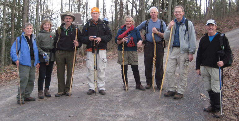
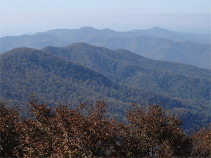
Post Trip Report: We had an AWESOME turnout for our Big Frog Loop hike. There were a total of 11 persons who hiked with us that day. The weather was sunny and the temperatures were pleasant. We climbed "the Frog" going up the Benton MacKaye Trail and came back down on the Big Frog trail for a total of slightly more than 13 miles. We had some especially good views to the east where we could see the Copper Basin area and where Hwy. 64 goes through the mountains into North Carolina. We could also see Chilhowee Mountain to the north and Sugar Loaf near the dam. We had a little excitement with our stream crossings since we had some recent rain. Everyone made it across without too much difficulty though. We also experienced a Rhododendron tunnel about 100 yards long near the top. It truly was a great day to walk in the woods while enjoying good company and good scenery.
![]() Contact the
Webmaster
Contact the
Webmaster