Cherokee Hiking Club
198 Crews Drive, Benton, TN 37307
Backpack
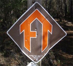
on
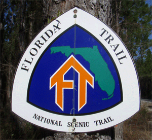
the Florida Trail
Econfina Creek Section
Wednesday-Thursday,
March 12-13, 2008
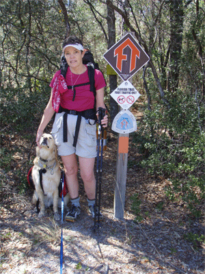
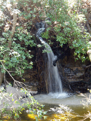
Brief Description: Rick & Brenda Harris and their Golden Retriever Jake backpacked this beautiful section of the Florida Trail in the Panhandle just north of Panama City. Econfina Creek is a fast-flowing spring-fed creek in a gorge. This creek becomes the water supply for Panama City. This section is labeled by Johnny Molloy in his book on his thru-hike on the Florida Trail as the most beautiful section of the Florida Trail.
Length: 19.3 miles
Difficulty Rating: Easy
Elevation Gain: Only about 100 feet
Hike Leader: Jake, our dog (he lead us the whole way)
Other Useful Links: www.floridatrail.org
Directions to the Trailhead: We started from the Scott Road Trailhead off of US 231 and ended at the FL 20 trailhead west of the bridge over Econfina Creek. See the access map.
Special Notice: We have been recently notified that there are two seperate steel cable suspension bridges now on this section of the Florida Trail: one at Two Penny and one at Fender Bridge. Thus, the description below is no longer fully accurate. For further updated information, contact the Florida Trail Association at www.floridatrail.org.
Trail Description: We had a member of the Florida Trail Association, Captain Richard Walker and his wife Janet, meet us at the FL20 trailhead,
which is about 3 miles west of the bridge over Econfina Creek. We left our car there, then Richard and Janet drove us up to the Scott Road parking area. Richard and Janet joined us for the first couple of miles to the first bridge over the creek. Richard has been responsible for the construction and maintenance of almost all of this section of trail. The trail enters a pine forest and goes about a mile before it finally comes to the edge of the creek. We then hiked by Econfina Falls, which is a side creek entering the river over the bluff from the opposite side of the creek. This is one of the only waterfalls in Florida. The trail then follows the west side of the creek downstream in a beautiful little valley until it crosses to the west side over a log bridge at mile 1.3. The log is covered with fencing material to improve traction and two steel cable railings
help you maintain balance. Jake was scared at first, but slowly crossed while Brenda coaxed him over with a peanut butter cracker (his favorite treat). The trail then followed the west side of the creek for several miles, then again crossed over to the east side on a new suspension bridge called Fender Bridge at mile 4.6. We passed by some 50 foot sand bluffs overlooking the river at mile 7.8. These were very pretty with the creek running down in the bottom. We then followed the creek further downstream to our campsite at Devil's Hole at mile 8.8 (9.5 on my GPS). This site is a beautiful campsite between two clear ponds deep in the woods. The site sported a picnic table and a flat area for our tent. We ate our supper (potatoes alfredo) which we prepared by pouring boiling water into ziplock bags and stirring, then let sit for 5 minutes. Very simple. We used an alcohol stove for boiling the water. No clean up. All very light. Our packs only weighed about 20 pounds each. We read our books, then retired for the evening about 10PM. During the day, the temperature was about 65 degrees, but the night turned quite cold, in the mid 30's.
On Thursday morning we woke around 7AM. Brenda was quite cold with her thin sleeping bag (we were not expecting such low temperatures). We ate our oatmeal breakfast, then headed down the trail around 8AM. It warmed up quickly and we were in T-shirts and shorts by about 10AM. We crossed the river on the metal Walsingham Road bridge at mile 9.9, then again went by some high bluffs over the river at mile 10.7. Shortly south of here, the trail is detoured around a forest which is being logged. We traveled along the edge of fields or already logged areas and other areas in deep pine woods. We
also passed by a sinkhole with huge live oaks in the bottom at mile 16.8 and also a deep little valley with a creek flowing right out of the head of the valley. We also passed a few ponds and several nice campsites. We passed through one particularly pretty area of a young longleaf pine forest with the very long fluffy needle bunches. Finally the trail exited the forest into the parking area along FL20, 9.6 miles from Devil's Hole (9.8 miles by my GPS).
Jake, our Golden Retriever, was great on this trip. We had him carry his own food in a saddlebag which worked well. He did not seem to mind carrying the extra weight at all. Each day he would get a little tired around about mile 8 or so. He would start looking for a cool soft area to lie down. There is lots of flowing water along this route, so water was never a problem for Jake or for us.
I agree with Johnny Molloy that this section of trail is very beautiful, but if I were to choose, I think the Aucilla River section was prettier. The Econfina is much more conducive to swimming, but the Aucilla is really cool with its fast flowing deep river which keeps disappearing and reappearing in the sinks section.
If you are interested in doing this section, you should 1) join the Florida Trail Association, and 2) contact the FTA to help you arrange a car shuttle with the local FTA members. This was a great backpack trip, and I would highly recommend it to anyone. The best time to go is probably in mid-March, as we did it. Earlier and it is too cold and there are too many hunters in the woods. Later and it gets to hot for comfort.
Also, the Florida Trail would make a great wintertime thru-hike. It is 1100 miles. Most people hike from the Big Cypress Swamp on the south end up to the Blackwater River Forest or the Gulf Islands National Sea Shore to end the hike. There are 3 places where you must choose which way to go. I would recommend backpacking the west side of Lake Okeechobee since it is more remote. I would hike the east route through the Ocala National Forest, since the trail is better maintained and more remote at present. And I would suggest ending in the Blackwater River area, again since this area is more remote. The best time to start is mid to late January, finishing mid to late March. This avoids the hunters and gives the best weather and least bugs. Also, this timing allows you also to hike the Appalachian Trail or the PCT or CDT during the same summer without overlap, if you are a glutton for punishment.
Contact the Webmaster