Cherokee Hiking Club

Cherokee Hiking Club Calendar
2016
Hike Difficulty Rating Scale (per Chattanooga Hiking Club)
Check out the
Sequoyah Hiking
Club Activities
CHC Hike Calendar for 2016 - good for printing
Jan Feb Mar Apr May Jun Jul Aug Sep Oct Nov Dec
Tennessee Wild Hike/Backpack
Schedule
Benton MacKaye Trail Assn Hike
Schedule
1/10, Sunday January Monthly Meeting and annual Hike and Event Planning Meeting – January 10, Sunday
We will meet at 2:00 p.m. in the Family Resource Agency’s conference room, as in ages past. We will be planning future hikes, meetings and other events for 2016. If you are interested in leading a hike in 2016, or would like to provide any other positive input or constructive advice, please attend! Non-members interested in joining the club are also invited. If you come, feel free to bring refreshments, but this is not required. (Coconut cream pie, pecan pie and carrot cake will be especially appreciated; also coffee and drinks.) James Anderson will host the meeting. See newsletter for exact location directions. The tentative schedule assembled at this meeting is available here.
1/16, Saturday - Graysville Mtn Section of the Cumberland Trail - this is a new section. Leader Randy Morris, 8 miles round trip, moderate, along Roaring Creek. Rescheduled from 11/7/2015, when it got rained out.
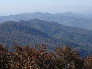
Hike Report: Four club members enjoyed a nice January day for hiking, as we explored part of the Graysville Mountain Section of the Cumberland Trail high above the metropolis of Graysville TN. We hiked approximately 8 miles roundtrip, with about one-half of the hike on relatively new trail created by recent spring break work trips coordinated by the Cumberland Trail Conference. The hike began along beautiful Roaring Creek, which lived up to its name with all of the recent rains. We then climbed about 900 feet up the mountain and enjoyed several nice overlooks, including Roaring Creek, Cranmore Cove and Cove Loop; eating lunch at the latter. We also enjoyed two small but beautiful waterfalls - Graysville Falls and Wildcat Hollow Falls, being glad that the wildcat was nowhere to be found. Hikers included Buddy Arnold, new member Mike Friedman, Kathy Seymour, and hike leader Randy Morris. Below is a picture of our smiling hike leader, surrounded by two of his stalwart companions on the path, Kathy Seymour and Buddy Arnold. More pictures of this event can be found at http://www.meetup.com/Cherokee-Hiking-Club-of-Southeast-Tennessee/photos/26700495/.
1/16-17, Saturday-Sunday – Sandhill Crane Festival - sponsored by TWRA (Tennessee Wildlife Resources Agency) and corporate sponsor Olin Chlor-Alkali Products. At Hiwassee Refuge and Birchwood community Center. See https://www.tn.gov/twra/article/sandhill-crane-festival.
1/28-31 Thur-Sun - Southeastern Foot Trails Coalition Conference – January 28-31, 2016, Thursday-Sunday
The Southeastern Foot Trails Coalition (SEFTC) will hold its biennial conference in the winter months this year. This will include 3 days of hikes on Thursday, Friday and Sunday. The SEFTC is a coalition of hiking and outdoor clubs around the Appalachian Southeast, and the Cherokee Hiking Club is and has been a member for a number of years. This event, formerly held in June, was moved to the winter months, since Wilderness Wildlife Week (WWW) was moved from January/February to May; many people still wanted an outdoor event of this magnitude to be held in winter. CHC member and webmaster Rick Harris has been the club’s representative to the Conference. Club members are encouraged to attend. For more information on the Conference, including costs, lodging information and a registration form, go to http://www.southeasternfoottrails.org/website-message-for-2016-meeting.pdf. You can also contact Rick Harris at HarrisRI@aol.com for more information on this event.
2/6, Saturday – Big Creek Trail/Grassy Gap Trail/ Yellowstand Lead Trail -hike on the bottom slopes of Big Frog Mountain, leader Jack Callahan. 6.5 mile loop, moderate, 1000 feet elevation gain, a possible stream crossing. Limited to 10 hikers. Meet at 9:00 a.m. at the Thunder Rock Campground parking lot. To reserve a slot, you must contact Jack Callahan at 423-284-7885 or jackn1945@bellsouth.net.
This hike will take place on the bottom slopes of Big Frog Mountain. There will be a possible stream crossing, so please bring the appropriate shoes, a change of socks, and some plastic bags with strong rubber bands to fasten around your hiking shoes. This hike will be limited to 10 hikers, so please make sure you contact the hike leader in plenty of time to get your name on the list. We will meet at 9:00 a.m. at the Thunder Rock Campground parking lot. To reserve a slot, you must contact Jack Callahan at 423-284-7885 or jackn1945@bellsouth.net.
Hike Report: This hike took place on the bottom slopes of Big Frog Mountain. Those attending included Michael Friedman, Brenda Harris, Randy Morris, Margaret and Jack Callahan (hike leader) and two guests. Pictures of this event can be viewed at http://www.meetup.com/Cherokee-Hiking-Club-of-Southeast-Tennessee/photos/26725177/.
2/6, Saturday – Thunder Rock Hike - leader Clayton Pannell. 3.5 miles with car shuttle, easy. Optional additional mileage for those who would like to attempt it, on the nearby connecting trails. Meet at 9:00 a.m. at the Thunder Rock Campground parking lot.
This hike has become an annual January/February club tradition, taking place on the Tanasi Trail System in back of the Ocoee White Water Center. See http://www.fs.usda.gov/Internet/FSE_DOCUMENTS/stelprdb5278526.pdf for a map of the Tanasi Trail System.We will meet at 9:00 a.m. at the Thunder Rock Campground parking lot (the #3 TVA Power House). We will do a short car shuttle up to where the Benton-MacKaye Trail (BMT) crosses Forest Road 45. Then we will hike south on the BMT to where the Thunder Rock Express turns left down an old road, and then onto a graded trail back to the power house. This is also a bike trail, so be aware that there may be bikers on the trail as well. As this is a winter hike, please dress for the weather, preferably in layers. Also bring water, food and any other things you may need. If planning to go, please call Clayton or e-mail him, as the weather may change the hiking plans. Contact Clayton at 423-263-9730 (home), 423-435-1848 (cell) or crpannell@comcast.net.
Hike Report: Three hikers came out to tackle the Thunder Rock Express trails, on a clear and great day to hike. The trail was in good shape, and the rock is still in the tree. Although Ruth Pannell was recovering from knee surgery, Ruth, along with a friend and her husband and hike leader Clayton Pannell, also hiked the flat and smooth Rhododendron Trail.
2/11, Thursday - Monthly Meeting - 6:00 p.m. at the Monterrey Restaurant in Cleveland. Ann Gray has reserved this.
2/13, Saturday – Flats Mountain Hike -, leader Rick Harris. 6.2 miles, moderately strenuous, around 500 feet elevation gain, near Indian Boundary Campground. Possible ice formation. Meet at Cherohala SkywayVisitor’s Center in Tellico Plains at 9:00 a.m. See old CHC writeup for this hike at http://www.cherokeehikingclub.org/Flats%20Mtn%20Trail.pdf. (Note: ignore the driving directions on this site, as we will be carpooling from Tellico Plains)
Contact Rick Harris at 423-253-6358 (home), 513-260-1184 (cell) or HarrisRI@aol.com if interested. Please meet at the Cherohala SkywayVisitor's Center in Tellico Plains at 9:00 a.m. to carpool to the trailhead.
Hike Report: Hike leader Rick Harris reported that this was a great hike. The temperature was around 10 degrees at the start and 20 degrees at the end. The sun was out, there was a plentiful layer of snow on the ground and the views were beautiful. The hikers saw plenty of animal tracks including turkey, hog, deer, coyote, rabbit, and boar tracks and lots of little bird tracks. Hikers included Rick Harris, Michael Friedman and one guest. Pictures of this event can be viewed at http://www.meetup.com/Cherokee-Hiking-Club-of-Southeast-Tennessee/events/228529057/.
2/20, Saturday – Rock Creek Trail Hike - in the Little Frog Wilderness Area, leader Randy Morris. We will start on U.S. Highway 64 and end on the BMT. 7.5 miles with car shuttle, moderately strenuous (uphill before the creek). There is a stream crossing of Rock Creek which will probably not be amenable to being rock-hopped, so please prepare.
This approximately 8 mile hike will be on the Rock Creek Trail in the Little Frog Wilderness Area. We will place a car shuttle and complete the hike from north to south—beginning at the Rock Creek Trailhead on Hwy. 64 and returning downhill via the Dry Pond Lead Trail (which is also the BMT). There is a small stream crossing of Laurel Creek which is normally easy, but Rock Creek itself is likely to require fording so be prepared to cross cold February water in a safe manner (large plastic bags secured high on your legs is one option). Along the way we should have some great views of the nearby mountains as the trail goes up the side of Panther Knob and into the beautiful Pressley Cove where we will encounter Rock Creek. As of last year, there was still a nice grove of Easter Hemlock trees bordering the creek which makes a great lunch spot (at about 4.3 miles). I am rating this hike as moderately strenuous as there are several climbs. We will leave from the back parking lot of the Ocoee Hardees at 8:30 a.m. and should be at the Thunder Rock Campground Parking Lot by 9:00 a.m. where we will stage our car shuttle. If interested in going please call Randy Morris at 423-650-0485 no later than 8 p.m. on Friday, February 19. Note that I will not be at the meeting locations if I have to cancel the hike so please call ahead so I can notify you of cancellation if necessary.
Trip report: Six club members trekked approximately 8 miles in the Little Frog Wilderness Area off Hwy. 64 on February 20. We enjoyed a nice warm day (especially for February), but endured a very light rain for the first half of the hike. However, it was interesting to see the fog form low in the valley of beautiful Pressley Cove and especially nice eating lunch beside Rock Creek as the soothing water tumbled over the rocks down the valley. Everyone made it across the creek fine—and in a variety of ways—from rock hopping, to wading, to marching across with large trash bags over the boots/legs. No matter the method, everyone stayed relatively dry. We enjoyed the views of the surrounding peaks in areas with little or no fog such as Panther Knob (no panther just a high knob), Big Frog, Little Frog, No Frog (why not?), and the backside of Oswald Dome. We met an adventurous trail runner coming up the Dry Pond Lead Trail and left the Rock Creek area just as the Chattanooga Hiking Club hike was arriving. Enjoying the day were James Anderson, Jack and Megan Callahan, Mike Friedman, Sue Robinson, and hike leader Randy Morris, reporting.
2/27, Saturday - Pickett State Park overnight trip with hikes - including views of up to 9 natural arches, leader Ann Gray. As mentioned in an article in the November/December 2013 Tennessee Conservationist, Tennessee has over 280 arches, with fewer than 25 on trails accessible to the general public. Pickett State Park itself has nine arches, making it the highest concentration of arches in the state. The trails to the arches there have an elevation gain of less than 100 feet with the total mileage less than six miles. The cabins, some of which were built by the CCC, have a two-night minimum ($60 per night), but we've been told that in the winter we could probably walk up and obtain a one-night cabin if they are not already booked. If not, there is Jordan's Motel, 20 miles away. We would be arriving Saturday morning and spend Saturday night there. Also to explore is Pogue Creek Canyon nearby, with a l.5 mile loop trail (rated moderate) to the scenic overlook of the canyon. There is a very good German restaurant (the Bacaras Family Restaurant) in the area, as also emphasized by Michael Friedman.
This event will incorporate a fun cabin stay with hikes, including views of up to 9 natural arches. As mentioned in an article in the November/December 2013 Tennessee Conservationist, Tennessee has over 280 arches, with fewer than 25 on trails accessible to the general public. Pickett State Park itself has nine arches, making it the highest concentration of arches in the state. The trails to the arches there have an elevation gain of less than 100 feet with the total mileage less than six miles. The cabins, some of which were built by the Civilian Conservation Corps (CCC) in the 1930's, have a two-night minimum ($60 per night), but we've been told that in the winter we could probably walk up and obtain a one-night cabin if they are not already booked. If not, there is Jordan's Motel, 20 miles away. We would be arriving Saturday morning and spend Saturday night there. Also to explore is Pogue Creek Canyon nearby, with an l.5 mile loop trail (rated moderate) to the scenic overlook of the canyon. For a special eating-out treat that we may explore, there is a very good German restaurant (the Bacaras Family Restaurant) in the area. See http://www.tnvacation.com/vendors/bacara-s-family-restaurant for contact information. We will meet at the Cleveland Home Depot parking lot at 9:00 a.m. on Saturday, February 27. Please contact Ann Gray at 423-240-8863 (cell) by Tuesday, February 23 if you are planning on going.
Trip Report: Al and Debbie Rymer and James and Christy Hardin arrived at Pickett State Park on Friday. Ruth Pannell, Karen Young and Ann Gray got there about noon on Saturday, and shared a cabin Saturday night with Edmond & Gail Gray, who had also arrived on Friday. The two groups didn't make the connection with each other due to poor cell phone connections. Al reported that his group saw three arches, and he learned that this is the first year there has been a bear season, with 200 bears killed in Pickett and Big South Fork. Ann's group was very impressed with Hazard Cave, which is actually a huge overhang. Like the synchronous fireflies of Great Smoky Mountains, the glowworms of Hazard Cave have achieved celebrity status on a smaller scale. The park leads glow-worm tours where the luminous larvae are believed to occur in greater abundance than anywhere else in the world outside of New Zealand. These tours are held May through September and we thought it might warrant coming back to Pickett S.P. to see the glowworms. We also hiked the Pogue Creek Canyon trail (1.75 miles long) and were impressed with the canyon overlook there. Any group that Ann leads must include food, so we ate Saturday evening at Bacara's Family Restaurant, which is a German restaurant 3 miles from Pickett S.P. Bacara’s is in an old schoolhouse and has been in business 23 years. It was excellent, and we ended the trip with another delicious meal at the Sunday buffet at Cumberland Mountain State Park in Crossville.
3/5, Saturday – Boyd Gap to White Water Center - leader Clayton Pannell. 3.5 miles with car shuttle, easy, mostly downhill. Meet at the WWC at 9:00 a.m. to set up the car shuttle.
3/10, Thursday - Monthly Meeting - 6:00 p.m., Golden Corral in Cleveland, TN
3/19, Saturday – Sandy Gap to Unicoi Gap/BMT Hike - leader Jack Callahan. 8 miles round trip, 1000 feet elevation gain, moderate. Good trail with a little water, but no stream crossings. This is a thru hike from Sandy Gap south to Unicoi Gap; it will require shuttling of vehicles. Limited to 10 hikers. Anyone wishing to join must contact Jack Callahan at 423-284-7885 or jackn1945@bellsouth.net to reserve a slot. Meet at the Coker Creek Welcome Center in Coker Creek TN at the intersection of Joe Brown Highway and U.S. Highway 68, at 9:00 a.m. to carpool.
3/19, Saturday – Bear Creek Loop Hike at Cloudland Canyon - leader Buddy Arnold. 9 miles, strenuous. About 9 miles total. I could not find elevation information, but looks like 1000 or so. There is a stream crossing that can cause the trail to be closed in wet weather. Rocky in some areas. TO BE RESCHEDULED
3/26, Saturday – Pocket Wilderness Hike/Rock Town Hike at Pigeon Mountain near Lafayette GA - leader Ann Gray. This event will consist of 2 hikes, 4.5 miles total, easy. The first will take place in the Pocket Wilderness of Pigeon Mountain, which is one of the finest areas for wildflowers in Georgia. This 2.5 mile loop trail contains nearly a quarter mile of boardwalk to prevent people from overrunning the wildflowers. There is a walk (not really a hike) up past the boardwalk with scenery to explore, including Pocket Creek Falls. See http://www.georgiatrails.com/gt/Pocket_Trail for a map and more info. For the second hike, we'll drive to the Rock Town trailhead for a 2 mile, easy roundtrip hike to the tallest spot on Pigeon Mountain. There is little change in elevation to the numerous sandstone “hoodoos”, one of which is called the Champagne Flute Hoodoo. See http://www.georgiatrails.com/gt/rocktown_trail for more info and a map for the Rock Town trail. Contact Ann Gray to sign up at 423 240-8863.
Trip Report: On a beautiful spring day, the large group, consisting of club members Margaret Callahan, Becky Levings, Lettie Burress, Al and Debbie Rymer, Letha Kelley and hike leader Ann Gray, and guests George and Judy Drapac (neighbors of Lettie Burress), Robert and Kim Riggs (neighbors of Al and Debbie Rymer), and Meetup guest Sandra Fenton met at the carpool location in Ooltewah for the long and interesting drive to the Pigeon Mountain Grill, with the exception of Letha and Sandra, who met us at the Grill. This group went through the Shirley Miller boardwalk for wildflowers at Pigeon Mountain. We saw numerous Virginia bluebells, trilliums, yellow poppy, and even elf cap mushrooms, identified by a botanist we met who knows our club president Leon Bates (our resident plant expert). We were especially happy to have Letha with us since this was her first outing since shoulder surgery in January. Our headquarters was the Pigeon Mountain Grill, about 10 or so miles south of Chickamauga GA, for our lunch and restroom facility. The food there is excellent and the restaurant was quite busy despite its remote location, with hikers, rock climbers and bicyclists among the clientele. Following lunch, the group drove through beautiful McLemore Cove, which is between Lookout Mountain and Pigeon Mountain, and past Mountain Cove Farms. When we reached the highest point on Pigeon Mountain, we had a 7-mile drive on a dirt washboard road to the trailhead area, which was filled with cars for both hikers and rock climbers. Over 200 million years ago this area was once a great ocean; it now consists of many boulders and outcroppings containing deposits laid down by that long-ago ocean. Letha had decided not to overdo it so she missed this hike, along with Becky whose car had developed a tire problem and had to return home. Hike leader Ann again apologizes to the group for the initial trouble finding the Pigeon Mountain Grill - Daniel Boone she is not! Our large and happy group is shown below at the Pigeon Mountain wildflower boardwalk entrance, except for Sandra Fenton and Becky Levings, who took the picture. More pictures of this event can be viewed at http://www.meetup.com/Cherokee-Hiking-Club-of-Southeast-Tennessee/photos/26854313/.
4/2, Saturday – Bald River Trail - leader Rick Harris. 9 miles round trip, moderate, from Tellico River Road to Bald River Road. Meet at the Cherohala Skyway Visitor’s Center in Tellico Plains at 9:00 a.m. See an old CHC writeup of this trail at http://www.cherokeehikingclub.org/Bald%20River%20Trail.pdf
We will actually run this as two hikes, each separated by a half hour or so. The “fast, more adventurous hikers” will hike all the way to the turnaround (a point at the falls about 4.5 miles in), and will eat lunch there. The slower group will turn around wherever they wish, but if they so desire they can also go the full distance. So a hiker might be thinking whether he or she wants to commit to the full 9 mile hike or might want to go with the "slower, less crazy" group with the possibility of not going in all the way. The hike is not very difficult, except for the distance. There is not much elevation gain or loss. The hardest section is the first mile or two with some minor rock scrambling; the last couple of miles are fairly flat with a smooth rockless trail. There are a few side creek crossings, but nothing major. I would suggest hiking poles, if you have them, to help with balance on the creek crossings, but any stick you pick up along the way will work as well. There are a few logs across the trail, but nothing that cannot be easily traversed. There is one big tree down in the trail that you have to squeeze by, but it is all very doable. If you decide not to go, please take your name off the reservation list in Meetup, so others can fill your place. Also, since we are running two groups, there is room for a few more last minute hikers. Just sign up on Meetup for the hike. We cannot go over 24 total hikers (both groups together). Be sure to bring a lunch and a couple quarts of water, or more. We will have water filters to make more water if needed. This hike will go regardless of the weather. Even if it is raining, we will go. It is actually pretty nifty hiking in the rain so long as you have a good rain coat and/or a hiker’s umbrella (a small umbrella which is not much wider than you and your day pack). And by going in the rain you will be earning a special badge of craziness to store away in your memory bank. But, right now, the weather looks great for this Saturday: 65 degrees with a 0% chance of rain. There should be full sun the whole day. Don't forget bug repellent and maybe suntan lotion, but for the most part you are under a thick canopy of trees. Afterwards, we may very well decide to go to the Tellicafe for supper. If interested in eating there with the group, please bring some money or your credit card. The food at the Tellicafe is very good and their Zango desert is an incredible treat. On Saturdays, they serve prime rib, by the way. Please come about 15 minutes early to the parking lot at the Cherohala Skyway Visitor Center so you can sign in and help in planning the car shuttle and sorting everyone out into the two groups. In other words, please be there no later than 8:45 a.m. If you have questions, email me at HarrisRi@aol.com or call me at 513-260-1184 (cell) or 423-253-6358 (home).
Post Hike Report: Rick Harris led the hike with 12 people, the limit for a designated wilderness area. Close to one half of the hiking group consisted of club members (Jack and Margaret Callahan, Michael Friedman, Sue Robinson and hike leader Rick Harris) and the rest were non-members (Tracy Brooks, Sandra Fenton, and Sandra Brooks with four friends) who had signed up via Meetup. He was going to run this as 2 hiking groups since the original number of interested people was higher, but since several cancelled, he only needed the one group. The group hiked to the upper waterfall, 4 ½ miles each way. Most of the group went to the Tellicafe afterwards and helped themselves to the excellent food. Several wildflowers were seen on the hike, and pictures were taken and posted on the club’s Meetup site. Pictures can be viewed at http://www.meetup.com/Cherokee-Hiking-Club-of-Southeast-Tennessee/photos/26861922/.
4/9, Saturday – John Muir Trail Cleanup - leader Clayton Pannell. 6 miles round trip or 3 miles with car shuttle, easy. Bring cleanup tools and work gloves. Meet at Childers Creek Parking area in Reliance TN at 9:00 a.m., or optional car pool at 8:30 a.m. at parking lot beside Hiwassee Corner Market on the corner of Route 30 and U.S. Highway 411 near Benton.
We will meet at the John Muir Trail Head at the Childers Creek parking area near Reliance TN at 9:00 a.m. The hike is a beautiful, easy 3-mile trail along the Hiwassee River. It can be either a 3 mile or 6 mile hike depending on time and if we have a car shuttle. Some wild flower will be in bloom, which can be very beautiful in the spring along the river. Work will consist of picking up small amounts of trash, lopping and trimming. If it is wet along the trail, we may have to do some tread work to get the water off the trail or drain mud holes. Please bring tools, work gloves, water, snacks, bug spray and dress for the weather. Helpful tools include sturdy clippers, a bow saw, loppers, and possibly a shovel or another tool to do the water turn outs. If you have any questions about what tools to bring or any other issue, please contact Clayton Pannell at 423-263-9730 (home), 423-435-1848 (cell) or crpannell@comcast.net . Directions from Cleveland: head east on U.S. Highway 64, and take the exit onto U.S. Highway 411. Turn left on 411, going north. Gothrough Benton, turn right onto Route 30 towards Reliance, take a left and cross the bridge at Webb’s Store, cross the railroad tracks, turn immediately right at Rosie’s Restaurant (closed) and follow the road until you reach the Childers’ Creek sign on the right. Turn into the parking area.
Post-Trip Report: Clayton Pannell led this hike and 5 people attended, including club members Carol and Carroll Guhne, Sue Robinson, Rick Harris, and hike leader Clayton Pannell. They filled one garbage bag with trash, filled a large hole and rerouted some water that was sitting on the trail, picked up an old tire that had been dumped, and otherwise cleared the trail of brush and overgrowth. Besides the lovely group picture below, more pictures of this hike can be found at http://www.meetup.com/Cherokee-Hiking-Club-of-Southeast-Tennessee/photos/26878400/.
4/14 -Thursday - Monthly Meeting - 6:00 p.m., location TBA.
We will meet at 6:00 p.m. at the Stadium BBQ in Delano TN. The address is 106 Savannah Shores Drive, Delano. For more information on this venue, including a map to the location, please visit their Facebook page at https://www.facebook.com/Stadium-BBQ-Delano-TN-644018805692995/. A menu can be viewed at http://www.stadiumbbq.com/our-menu.html?p_ref=pa . Directions from Cleveland: head east on U.S. Highway 64, and take the exit onto U.S. Highway 411. Turn left on 411, going north. Gothrough Benton, and cross the Hiwassee River. Soon after the river, the restaurant will be on the right on the corner of Savannah Shores Drive. Note: Al Rymer will be a leading a short hike before the meeting. The hike will start at 5:00 p.m. at the Gee Creek Trailhead near the Hiwassee-Ocoee State Park in Delano. For more information please contact Al at 423- 808-0011 (home) or 423-506-9350 (cell).
4/16 - Saturday - BMT Sandy Gap to Unicoi Gap - Jack Callahan, 8 miles, 1000 feet elevation gain
Note: this hike has been rescheduled from the original March 12 date, which had to be canceled twice due to the threat of thunderstorms. The original group was limited to 10 hikers; the group going on April 16 will be pulled from the original group, but there may be new openings if any of the original hikers cannot go on this date. Please contact Jack Callahan at the contact information shown below to get your name on the April 16 list. This is a good trail with a little water, but no stream crossings. This is a through hike from Sandy Gap south to Unicoi Gap; it will require shuttling of vehicles, and is limited to 10 hikers. Anyone wishing to join must contact Jack Callahan at 423-284-7885 or jackn1945@bellsouth.net to reserve a slot. Meet at the Coker Creek Welcome Center in Coker Creek TN at 9:00 a.m. to carpool. Directions to the carpool location from Cleveland: go east on U.S. Highway 64, and cross over U.S. 411. Continue on through the gorge until you reach Ducktown TN, where you will turn north on U.S. Highway 68. Continue on 68 north until you reach Coker Creek. The Coker Creek Welcome Center will be on the right at the intersection of Joe Brown Highway and U.S. 68.
Post Hike Report: The group worked hard, but it was worth it. It was 8.75 miles in total length, lots of ups and downs; nothing overly steep, but just lots of it. Just continued ups in the first 4 miles or so of the hike, and some after the midpoint, when we ate our lunch. Then it was down down down. The final mile was a blessing since it was on a relatively flat grassy road bed. No pain no gain! It was a beautiful day and great company. The hike leader had the patience of Job and was happy to share his water with those in desperate need. The ruined house of Doc Rogers, where we ate our lunch, was quite an interesting site. It must have been a beautiful home at some point. It was built in the 1940's, but was abandoned not long after due to some health issues of its owner. Attending the hike were club members Jack Callahan (hike leader), Margaret Callahan, Carolyn Hyde, Randy Morris, Rebecca Levings and son Brendan Levings; and Meetup guests Tracy Brooks and Peggy Noonan. Below are pictured Peggy, Carolyn, Randy and Brendan in a photo taken by Jack Callahan. For more pictures of this hike, see http://www.meetup.com/Cherokee-Hiking-Club-of-Southeast-Tennessee/photos/all_photos/?photoAlbumId=26899001.
4/16 Saturday - Trails and Trilliums Weekend with Hikes, South Cumberland State Park - sponsored by the Friends of the South Cumberland. See www.trailsandtrilliums.org for more info.
4/19 Tuesday - 4/23 Saturday - GSMNP Spring Wildflower Pilgrimage, Gatlinburg - CHC President Leon Bates will be leading several hikes. Registration will be at the Gatlinburg Convention Center and online. See www.springwildflowerpilgrimage.org.
4/30, Saturday – Shakerag Hollow/Perimeter Trail/Beckwith’s Point Trail Wildflower Hike at Sewannee University of the South - leader Leon Bates. 4.2 miles, moderate-strenuous.
This hike will take place on the beautiful campus of the University of the South in Sewannee TN. We will hike a portion of the Perimeter Trail through beautiful Shakerag Hollow (one of the best wildflower hikes in the Southeast) and return via the Beckwith’s Point Trail after a short detour to Green’s View. Most of this hike is fairly easy, but we will have a short steep climb out of a gorge and some other up and down segments; after all, we will be just off the edge of the western side of Monteagle Mountain on the University of the South campus. Also, portions are very rocky, so good hiking boots and poles are recommended. Hopefully, we will catch the wildflowers in spectacular form, but it all depends on the weather conditions between now and then. Please call Leon Bates at 256-710-5508 no later than 8 p.m. Thursday, April 28 if interested in attending to find out the meeting location and time.
Post Hike Report: Five hikers dodged rainshowers for a full day down and up the beautiful Shake Rag Hollow on Saturday, April 30. Club members Jack Callahan, Mike Friedman, Sue & John Robinson and hike leader Leon Bates trekked down to the Big Boulder Field where huge, stately Yellow Poplar, Basswood, Sugar Maple and Silverbell trees abound. As expected, the return trip provided new flowers and scenes undetected during our descent. Upon return to the trailhead we elected to make the one-mile loop to Piney Point, where the panoramic view overlooked Roark Cove and the flat topography of the Highland Rim. Mountain laurel, Smooth Serviceberry, Chokeberry, Jack-in-the-Pulpit and Walking Fern were in the early flowering stages. We also saw one lonely Pink Ladies-Slipper. Fall hikes in this area will yield spectacular vistas of colorful fall foliage; perhaps another hike can be planned for October. Below shows a picture of club president and leader of this hike Leon Bates with the club vice president Jack Callahan. The picture was taken by Michael Friedman. More pictures of this hike can be viewed at http://www.meetup.com/Cherokee-Hiking-Club-of-Southeast-Tennessee/photos/26935152/.
5/9-13, Monday-Friday, Cumberland Gap National Historical Park Campout - leader Jack Callahan. Various hikes and things to see, such as Pinnacle Overlook, Hensley Settlement. Campsites $20 per night, with senior rate $10/night. No reservations required. Electrical connection, flush toilets, warm showers provided. No shelter, so use tent camping or adjoining RV/camper camp sites. See http://www.nps.gov/cuga/index.htm.
Trip Report: On this campout, we took numerous day hikes, including 2 ten-mile hikes. Several of us hiked to the Sand Cave, then over to the White Rocks. We had wonderful views, and the Sand Cave is a sight to behold. We also found a group of yellow Ladies’ Slippers in bloom; perhaps more than 10 in a small area. These were quite a sight, as these are very uncommon. On Wednesday, we had planned a tour of a bat cave led by the park service, but the tour was canceled due to the threat of lightning. As a backup, most folks went to the Lincoln Museum at Lincoln College. On Thursday, we took another 10+ mile hike up to the ridgeline, and this time we were treated to dozens of pink Ladies’ Slippers in full bloom. After supper each evening, we were treated to some great music. There was a Dulcimer Festival going on all week in Loop B of the campground, and we took our chairs up there and enjoyed the music after supper each evening. There were several well-known musicians playing there, and it was a nice way to end the day. We also made a short hike up to the Cumberland Gap, following in the footsteps of Daniel Boone, and those others who used the Gap to cross over into Kentucky. The campground and facilities were very nice and well kept, with lots of hot water. Below is our group eating a delicious picnic lunch. Other inspiring pictures of this event, including the yellow Ladies’ Slippers, can be viewed at http://www.meetup.com/Cherokee-Hiking-Club-of-Southeast-Tennessee/photos/26969920/.
5/12 Thursday – Monthly Meeting - We will meet at 6:00 p.m. at the Charleston Park in Charleston TN. Please bring a potluck dish to share. You may also consider bringing a folding chair, as seating at the picnic tables is limited. See newsletter for directions.
5/15, Sunday – Tellico River Canoe Trip - leader Rick Harris. Trip to run on the lower Tellico River, from Tellico Plains to Tellico Lake. Meet with canoes behind the Cherohala Skyway Visitor’s Center at 9:00 a.m. Contact Rick Harris for questions at HarrisRi@aol.com or 423-253-6358 (H) or 513-260-1184 (C). This is an 11 mile canoe trip suitable for families with kids, but is fairly long. We will eat lunch on the way, so bring that and plenty of water with you along with suntan lotion, mosquito repellant, hat, life jacket, and swimsuit and towel. We also may explore Sinkhole Cave along the way, so bring a flashlight. And of course, bring some sort of dry bag to keep all this stuff dry and rope to tie it into your canoe or kayak. It is possible we may be pulling canoes over shoals if the water level is low, so be sure to wear some sort of water shoes.
Trip Report: Six kayakers and canoeists put in the river at the Highway 360 bridge in Tellico Plains on this cold but sunny morning, to float down the river to the takeout along Old Belltown Mill Road, for a distance of 6.5 miles. We decided not to go all the way to the Big Creek Takeout because the river was running low and the weather was rather chilly. But throughout the day, the temperature moderated and most everyone was in T-shirts by the end of the day. A short distance below Tellico Plains, three of our kayakers turned over at a particularly bad snag. It took us about a half hour to get everyone back in their kayaks and to find Bill Kamm's double bladed paddle a ways downstream. The river was running low but fairly swift, so the rest of the trip went smoothly. We stopped for lunch at Sinkhole Cave and explored the entrance to this rather sizable cave with a creek running out of it. We got to our takeout about 2:00 p.m., and then went to Kats Deli for an early supper. It was a great trip overall. Those attending included Rick Harris (leader), Brenda Harris, Bill Kamm and Carol Kamm, Robert Haile, and Susan Robinson. Robert, who recently joined the Club, is also a member of a canoe club in Knoxville. Below is a relaxing picture of the kayakers paddling down the lovely river. More pictures of this event can be viewed at http://www.meetup.com/Cherokee-Hiking-Club-of-Southeast-Tennessee/photos/27008366/.
5/18, Wednesday – 5/22, Sunday, Wilderness Wildlife Week - See http://www.pigeonforge.com/have-fun/smoky-mountains/wilderness-wildlife-week/ for more information.
5/21 Saturday – Cleveland State Community College Trail Cleanup -leader Rebecca Levings. 3+ miles of looping trails, easy. Bring cleanup tools and work gloves. Meet in the parking lot between the gym and the tennis courts at Cleveland State CC at 9:00 a.m. This is our semi-annual cleanup at Cleveland’s Community College. We expect to do some light sawing, lopping and trimming, so just bring light tools such as bow saws, loppers, clippers and garden or work gloves. Wear long pants, since there is poison ivy in the area. Bring bug spray as well since ticks and redbugs are starting up their springtime feeding and mating spree. Please also bring water and any snacks you will need. The CSCC doors will probably be locked on Saturday so it’s doubtful that vending machines will be available. Please arrive at 9:00 a.m. in the parking lot beside the tennis courts. Contact Rebecca by email at reblev155@aol.com or by phone at 423-310-0523 if you plan to attend or if you have any questions. For directions, see our newsletter.
Trip Report: It was an overcast and unseasonably cool day when four trail maintainers met beside the tennis courts at CSCC. Friend Frank Pack drove all the way from Blairsville, Georgia to assist Rebecca Levings (hike leader), and Clayton and Ruth Pannell from Cleveland. This maintenance was originally scheduled for May 7, but was rescheduled due to the college commencement activities on that date. The trail was beginning to get overgrown in certain areas, but overall it was not too bad. There was a 6-inch in diameter tree down on the far north end of the trail toward the front, along with a few smaller ones. The group was able to take these out with an axe and a bow saw. There was a bag of trash (containing a discarded child’s stuffed toy) found in the woods not far from the trail, but that was the only trash they found. Other than a fair amount of poison ivy encountered mostly on the north end, no problems ensued. The hikers, including the leader, made a mental note to bring a weed eater next time. As it was, a machete was used to beat this and other small plants back along the trail. For branches and thorns growing into the trail, we used loppers and clippers. The group separated into 2 subgroups and pretty much hit all the loops of the trail. About an hour into the maintenance, the sky began to turn dark and the rain came down for a few minutes. It then stopped, leaving the maintainers to continue their work undisturbed. All was done in two hours and a half; then the sky got dark again, just in time for the baseball game at the campus diamond. The foursome then went out to lunch at the Deli Boys sandwich shop in Cleveland, where they enjoyed some delicious sandwiches, chips and drinks. Thanks much to Ruth Pannell for introducing everyone to this popular local venue! Note: Rebecca Levings attended a meeting with the Healthy Campus committee of CSCC, at the College on April 30, 2016, related to our maintenance of this trail. Notes from that meeting are included in this newsletter, after our May meeting minutes.
6/1, Wednesday - Bob Bald Hike - 8 miles roundtrip, 1000 foot climb. This is a hike with the Benton-MacKaye Trail Association (BMTA), but is open to members of the Cherokee Hiking Club. We will meet and carpool from the Cherohala Skyway Visitor Center in Tellico Plains TN at 9:00 a.m. Then the carpoolers will park at the Unicoi Crest Overlook on the Cherohala Skyway and hike on the BMT to Cold Springs Gap, then to Bob Bald for lunch and great views. The one-way distance is about 4 miles, round trip 8 miles. There is about a 1000 foot elevation gain to the Bald. Please bring at least 2 quarts of water and a lunch. If interested in attending, call/email Rick Harris at 513-260-1184 (cell) or HarrisRi@aol.com to sign up.
Post Trip Report: This hike was a joint Benton-MacKaye Trail Association (BMTA) and Cherokee Hiking Club hike. Ten folks hiked to Bob Bald along the BMT from Beech Gap on Wednesday, June 1. We all met at the Cherohala Skyway Visitor Center and carpooled to the Unicoi Crest Overlook on the Skyway. We hiked from the Overlook to Beech Gap, then followed the Benton-MacKaye Trail (BMT) to Cold Springs Gap, then climbed the 900 feet to the Bald. The trail was in excellent shape, thanks to BMT section maintainer (and now CHC member) Larry Van Dyke. When we arrived at Bob Bald, storm clouds were forming and thunder could be heard in the distance. Thus we ate a quick lunch, then headed back down the mountain. Round trip distance was about 8 miles. Once we all returned to our cars, we then returned to Tellico Plains and ate dinner at the Tellicafe. It was a great day in the mountains at elevations above 5000 feet. Those on the hike were CHC members Rick and Brenda Harris (hike leaders), Elizabeth Weikert (just joined) and Michael Friedman; others included Sandra Fenton, Bob Brown, Howard Baggett, Christy Collins, Ken Cissna, and HP Boudet. Pictures of this hike can be viewed at http://www.meetup.com/Cherokee-Hiking-Club-of-Southeast-Tennessee/photos/27013638/.
Post Trip Report: Eight human hikers and one dog enjoyed the 3.5 mile round trip hike to the "Whigg", with temps in the low 70's and a mix of sun and clouds. Thanks to Mike Friedman for lugging his tripod up for the group photo, and to Joanne Jackson for driving 950 miles from Texas just to join us! Rick took us on a nice side trip to the pond and the site of the Whigg cabin, now long gone. Thanks to Carolyn Hyde who brought a visitor, who liked us well enough to join the club about a week later....welcome Faye Nicholson! Hikers included club members Jack Callahan (hike leader), Margaret Callahan, Michael Friedman, Rick and Brenda Harris with canine Jake, Joanne Jackson, Carolyn Hyde and guest Faye Nicholson. Several wild azaleas were in bloom, and although it was a bit hazy, the views were still nice. Below is pictured Michael doing his thing with his camera and tripod. See the Meetup site for this event at http://www.meetup.com/Cherokee-Hiking-Club-of-Southeast-Tennessee/photos/27021023/ for more pictures, including a group photo, pictures of the lovely flame azaleas and more.
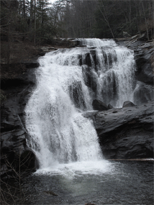
6/5, Sunday – Scenic Spur Trail - leader Clayton Pannell. 4 miles, easy to moderate. This will be a nice Sunday afternoon hike to a waterfall. There are two creek crossings, so hikers may want to bring water shoes to wade the creek. The trail ends at the first waterfall; some may want to “bush whack” to the second waterfall. Remember to wear long pants in the event of thorny bushes or poison ivy! Also remember bug spray; the ticks are out and are hungry. And of course, always bring plenty of water. We will meet at the Hardee's in Ocoee at 2:00 p.m. to car shuttle to the trail head off Highway 30, near U.S. Highway 64. If interested in attending, please contact Clayton and Ruth Pannell at 423-263-9730 (home), cell phone 423-435-1848 or email crpannell@comcast.net . CANCELLED DUE TO HEAVY RAINS
6/9, Thursday – June/July Monthly Meeting - We will meet at 6:00 p.m. at the Charleston Park in Charleston TN. Please bring a potluck dish to share. You may also consider bringing a folding chair, as seating at the picnic tables is limited. We also will hold the first-time Phil and Lettie Burress Courage Hike on the handicapped accessible trail around the park.
6/16-17, Thursday-Friday, Gregory Bald Hike near Townsend TN - leader Buddy Arnold. This hike will take us near Townsend, TN (not too far from Gatlinburg), in the Smokies. The trailhead to the Gregory Bald Trail is accessed by going through Cades Cove to the Forge Creek Road, and then to the one-way Parson Branch Road. The trail is about 5 miles one way, with an elevation gain of about 2100 feet. Buddy plans to leave for Townsend Thursday afternoon June 16, spend the night there, and leave at 8:00 a.m. on Friday, June 17 for the trailhead. Hikers could also leave Cleveland or other locations early on June 17 and meet in Townsend to depart for the trailhead. Another option would be to camp in Cades Cove. After the hike, hikers can return to Townsend via Parson Branch Road, then to U.S. Highway 129, and to the southern section of Foothills Parkway. This trail is famous for native azaleas which should be blooming then. More information on the trail can be found at http://www.hikinginthesmokys.com/gregory_bald_trail.htm. If you are interested in attending, and/or need more information, contact Buddy Arnold at 601-415-3551 or 423-339-2621.
Post trip report: Seven hikers, including club members Buddy Arnold (hike leader), Rick and Brenda Harris, Jack Callahan, Randy Morris, Michael Friedman, and guest Dave Olsen started the strenuous hike up the Gregory Ridge Trail about 9:00 am. The Parsons Branch Road to the Gregory Bald Trail was closed, so the Gregory Ridge Trail was used instead. The weather was warm and humid, so the 5.5 miles and 3000 feet elevation gain was quite a challenge. The first couple of miles were not too steep; we crossed over several foot bridges along a beautiful stream. About 2 miles in, the trail became much steeper at about 800 feet per mile. As we got higher we began to have nice overlooks and a refreshing breeze to cool us. There were some impressive old growth poplars in several areas. At about 4 miles, we started to see a few flame azaleas, getting us ready for the big show on the bald. At about 5 miles, we reached a trail junction, and started a very steep climb of 20 percent or so that flattened out before we reached the Bald a little after 1:00. We were greeted with a cool breeze and a temperature of 64 degrees that felt fantastic after the long climb. The azaleas were at or near their peak with multiple colors and large blooms. Several of us had been to the Bald before, but had never seen the azaleas blooming in such amount or beauty. It was hard work to get there, but I think all would agree it was well worth it. We spent an hour or so on the Bald, just enjoying the views and having our lunch. In addition to the azaleas, there were many other wild flowers and impressive groves of huckleberry bushes. The views of Cades Cove below and nearby mountain ranges were some of the best I have seen in the Smokies. We started our hike down about 2:30 and completed the about 12 mile trip about 5:00 or so. Below is pictured 6 of our group, in front of some of the beautiful azaleas that we encountered. Taking the picture is Michael Friedman. More pictures of this event can be found at http://www.meetup.com/Cherokee-Hiking-Club-of-Southeast-Tennessee/photos/27079555/.
June 20-23 - Appalachian Trail Backpack
This was not a club-sponsored hike, but several club members attended. There were a total of 6 hikers including club members Rick Harris, Jack Callahan (hike leader) and Megan Callahan; the others included Stuart Johnson, Kevin Sigward and Jerry Schneider. We hiked from the Rhododendron Gardens, approximately 3 miles southeast of Carvers Gap, to Highway 19E; this was a 20 mile hike on the AT with a total evaluation gain of slightly more than 3000 feet. We spent the first night on Grassy Ridge, elevation 6250 feet, with some fantastic views from the Bald. We encountered the typical strong winds all night with temps in the low 50's. On Tuesday we hiked along the AT and took a side trip to the Barn shelter for lunch and water. We had planned to spend the night on Yellow Mountain, another bald, but the trail was not well defined and potential rain and high winds dictated that we camp in a more sheltered location. This location turned out to be Bradley Gap. On Wednesday morning we saw heavy fog after a night of rain; we hiked up across Big Hump with a visibility of around 200 feet max. Winds were in the 30 MPH range. We went on to Doll Flats for lunch, then on to the vehicles. The first two days of great clear weather made up for the one day of rain; Grassy Ridge is a wonderful location that is also favorable for a day hike. The club might consider a group campout at Roan Mountain State Park, as well as several day hikes to these great locations. Below is a breathtaking view of the rhododendrons in bloom; more pictures of this event can be viewed at http://www.meetup.com/Cherokee-Hiking-Club-of-Southeast-Tennessee/photos/27079433/.
7/9, Saturday – Sequatchie Canoe Trip - Chris Swain. Bring your own canoe or kayak, or rent one close by for around $50. Swimming will also be available.
Chris will be leading a 6 or 9 mile trip out of the Canoe the Sequatchie outlet. He plans to get started by 9:00 a.m. CDT, so please meet at Canoe the Sequatchie at the location given below. Note: this time is Central Daylight Time! Chris stated that the location is about an hour from Cleveland. He recommends bringing a small cooler with plenty of fluids and some snacks and/or lunch. He will be in touch with this business to make sure the water level is good the week of the trip, so please contact him before attending. Everyone is responsible for renting their own canoe. He recommends having a partner for the canoes rented out at Canoe the Sequatchie; he will be available if someone does not have a partner. Please meet at 9:00 CDT at: Canoe the Sequatchie, 12800 U.S. Hwy. 127, Dunlap, TN 37327
7/14, Thursday – no Monthly Meeting this month since it was combined with the June meeting.
7/16, Saturday – Hiwassee Canoe Trip - Clayton Pannell. Bring your own canoe or kayak, or rent one.
We will meet at the Gee Creek Campground's boat ramp in the Hiwassee/Ocoee State Park at 2:00 p.m. Everyone is responsible for bringing (or renting) their own canoe or kayak, as well as water, snacks, life jackets and other gear. Note: each person floating must wear a life jacket!Club member Boyd Firestone plans to help with the shuttle, and we may need others to take vehicles to Patty Bridge as well, depending on how many attend. We will start our float trip as soon as the water starts to come up in the river. If interested, please contact Clayton and Ruth Pannell at crpannell@comcast.net , cell 423-263-9730 or home 423-435-1848.
7/17, Sunday – Gee Creek Falls/Lowry Falls Hikes - Al Rymer. 2 hikes in one, totaling less than 3 miles. Gee Creek Falls trail – easy, 2 miles or less round trip, Lowry Falls trail – moderate/strenuous, .4 miles round trip. Meet at 2:00 p.m. Possible dinner afterwards at Stadium BBQ.
This will be 2 hikes in one, totaling less than 3 miles. Both trails are in or near the Hiwassee/Ocoee State Park near Delano TN. The Gee Creek Falls Trail near Delano TN is rated easy, and is 2 miles or less round trip, Lowry Falls Trail is rated moderate/strenuous, with a length of .4 miles round trip. We will meet at 2:00 p.m. We may meet for dinner afterwards at the Stadium BBQ in Delano. Please contact Al Rymer for where to meet at 423-808-0011 (home), 423-506-9350 (cell) or via email at arymer2016@gmail.com.
8/11, Thursday – Monthly Meeting at 6:00 p.m., Ocoee/Hiwassee State Park Headquarters
The meeting will be held at 6:00 p.m. at the Ocoee/Hiwassee State Park headquarters (also known as Gee Creek SP). Richard Taylor will speak to the club about hike emergencies, such as helping a severely injured hiker to safety, or dealing with a deceased hiker. Mr. Taylor has served as a search and rescue person in the Cherokee National Forest and surrounding areas for many years now and has helped save many lives in the wild. We will have a pot luck dinner, then a short business meeting before Mr. Taylor’s presentation. Please bring a dish to share at the pot luck. All are welcome, so bring a friend!
8/13, Saturday – Arbutus Trail - leader Leon Bates. This is one of the trails in the Chilhowee Recreation Area. It is a 4.5 mile loop around Benton Falls. Rated easy.
This will be an easy hike in the Cherokee National Forest near McCamy Lake and Benton Falls. Members interested in carpooling should meet at 8:00 a.m. at the Ocoee Hardees’ back parking lot. Others may elect to meet at the McCamy Lake parking lot at 9:00. If meeting at the McCamy Lake parking lot, keep in mind that a parking fee of $3.00 per car is required unless you have a USFS recreation area parking pass. We will follow the Azalea Trail from the parking lot about 2 miles to the junction of the Arbutus Trail, then follow Red Leaf Trail about 0.3 miles to the Benton Falls Trail. Benton Falls is about 0.5 miles from this junction. Hikers are encouraged to bring a lunch or snack and plenty of water. Expected return to the parking lot is around 3:00 pm. The hike takes place on a few of the trails in the Chilhowee Trail System, and constitutes a loop around Benton Falls. See the map of this trail system at http://tennesseeoverhill.com/wp-content/uploads/2014/11/ChilhoweeTrailSystemMap.pdf. If you are interested in attending, please contact Leon Bates at 256-710-5508 (cell) or Lpbates1964@gmail.com.
On Saturday, Aug 20 we will offer a canoe/kayak trip on the Hiwassee River from the put-in at the Apalachia Powerhouse downstream to the take out by the railroad bridge at Reliance. You can bring your own canoe or kayak or rent one at Webb Bros or Hiwassee Outfitters. We will put in on the river Saturrday at 11 AM, when TVA opens up the turbines. We will meet at the State Canoe/Kayak Put-In by the railroad bridge in Reliance at 10:30 AM, then carpoor from there to the put-in by the powerhouse. This is a solid class II section of river. You should have some experience in a canoe or kayak to run this section. This is the section which many groups such as the Sierra Club teach kayaking and whitewater canoeing. Saturday night you could camp out at Parksville Lake Campground or elsewhere, then join in on the hike on Sunday AM. For the hike, we will meet at the Childers Creek Trailhead of the BMT/John Muir Trail at 10 AM, then carpool back up to the powerhouse. We will hike upstream along the river for a mile then join the BMT/JMT and head south back to Childers Creek TH. The distance is about 8 miles. Much of this route is along the edge of the beautiful Hiwassee River. Come either Saturday or Sunday or both days. Let me know if you plan on coming. Contact me at 513-260-1184 or 423-253-6358 or HarrisRi@aol.com. Rick Harris
8/21, Sunday – Hiwassee Float Trip to Patty Bridge - using car shuttle, leader Clayton Pannell. Meet at 2:00 p.m.
We will meet at the Gee Creek Campground's boat ramp in the Hiwassee/Ocoee State Park at 2:30 p.m.
Everyone is responsible for bringing (or renting) their own canoe or kayak, life jackets, paddles and other gear, along with water and snacks. We plan to start as soon as the water starts to come up. Note: each person floating must wear a life jacket. Boyd Firestone plans to help with the shuttle. We also may need to take more vehicles to Patty Bridge. If interested, please contact Clayton and Ruth Pannell at crpannell@comcast.net , cell 423-263-9730 or home 423-435-1848.
The Club has scheduled an outing to tour the famous “Bomb Plant” used to create the A-bomb by Oppenheimer and others for the top-secret Manhattan Project. This plant’s location in Oak Ridge TN (25 miles from Nashville) was top secret for many years. The proposed one day field trip will be led by club vice president Jack Callahan on August 24th, 2016. The U.S. Department of Energy will conduct the bus tour of the facilities of the historic reactor sites and the related area of the "bomb" plant. The tour bus loads at the Energy Museum in Oak Ridge at 11:30 a.m. and the tour ends around 2:30 p.m. The cost is $5 or $4 for seniors, which includes admission to the museum. The tour stops at 3 different sites, where we will get off the bus and do some walking; however this event would not be considered a hiking event. There are also stops at two more sites which do not involve getting off the bus. The museum opens at 9 a.m. The maximum number of seats which can be reserved is 18, and they are being reserved continuously online. Those who have reservations already include (but are not limited to) the following: Clayton and Ruth Pannell, Joanne Jackson, Bill and Ann Gray, Carolyn Hyde, Jack Callahan (leader) and Margaret Callahan. At this writing, there is now 1 seat left which can be reserved. Anyone wishing to join our group should go to the website http://amse.org/2016-doe-public-bus-tour/ , select the August 22-26 date range and then select the August 24 date from the popup window. Fill in the required fields, and select the number of seats you want to reserve for your party. Then click the Submit button. There is also a lot of information about the museum and the bus tour on the main part of this site (see the links at the top) to give you an idea of what to expect. As we get the final list of participants, we can discuss carpooling options and departure times. For any questions, please contact Jack Callahan at 423-284-7785 or jackn1945@bellsouth.net .
9/8, Thursday – Monthly Meeting at 6:00 p.m., Charleston Park in Charleston, TN
9/17, Saturday – Ruth’s Aster Hike - leader Ruth Pannell. The new trail reroute is done. If it is not too difficult, we will take that trail to the Narrows where the rare Ruth’s Aster is blooming at this time. Otherwise we will take the old trail as we did in September 2015. 4-5 miles, moderate. Meet at the parking lot beside the Hiwassee Corner Market on the corner of Highway 30 and U.S. Highway 411 near Benton, to carpool.
This hike will take place on the same trail as we used in September of last year, because the completed reroute is fairly steep and is longer. This route traverses a section of the John Muir Trail that overlaps with a section of the Benton MacKaye Trail. The trailhead for this route begins very near the end of the public road leading to the TVA Appalachia Power House near Reliance TN. If anyone would like to try the reroute and meet us at the rocks where Ruth's Golden Aster grows, that would be great. The newer rerouted section begins at the trailhead by Towee Creek, also off the same road that leads to the Appalachia Power House. This special rare aster only grows in the rocks and not in meadows, as far as we know, and should be in bloom right around the time we arrive. We will enjoy all the flowers in bloom, eat lunch at the rocks and enjoy the river at the nearby beach spot called the “Narrows”, and then return. Hikers should bring rain gear just in case of a downpour. We will carpool from the parking lot across from the Hiwassee Corner Market, just north of Benton at the corner of U.S. Highway 411 and Highway 30. Meet there at 9:00 a.m.; bring a lunch and plenty of water. Water shoes are advised, as the trail in some places is quite wet. Also please bring bug spray, as this same trail section is prey to a major mosquito infestation. In case of rain, a light poncho or other rain repellent clothing would also be helpful. For more information or updates, please contact Ruth or Clayton Pannell at 423-263-9730 (home), 423-506-9623 (Ruth’s cell) or 423-435-1848 (Clayton’s cell).
Trip Report: The Cherokee Hiking Club members and guests met at the Hiwassee Corner Market at the corner of Highway 30 and U.S. 411. We travelled to the Appalachia Power House parking lot, where one more person joined us. Altogether, nine people hiked John Muir Trail #152, starting under the bridge at the power house to an area close to the Narrows. The weather was perfect, but a bit warm by the time of the return hike. This was an adventurous, eager group, asking our own Club botanist, Leon Bates, many questions about flora most of the 2 miles in and back out (about 4 miles total). This is a beautiful area and was a great place for us all to enjoy a nice leisurely lunch. Even the yellow jackets, flies, gnats, and no-see-ums didn't bother us much! We also saw some of the Golden Aster, which is really yellow, and they were not all in full bloom yet. Ruth was not sure if lack of rain, intense heat, or being too early in the month was responsible for the relative lack of bloom. Attending were club members Ruth Pannell (leader), Leon Bates, Linda Kryssing, Larry Van Dyke, Sue Robinson, Jack and Margaret Callahan and guests Megan Callahan and our former club secretary Rick Foster. It was a great hike and thoroughly enjoyed by all. Try to join us next year! Below is a picture of our featured flower, Ruth’s Golden Aster, thanks to club member Larry Van Dyke. For more pictures of this hike, please go to http://www.meetup.com/Cherokee-Hiking-Club-of-Southeast-Tennessee/photos/27306387/ .
9/25-27, Sunday-Tuesday - Backpack on the Appalachian Trail – Hike leader: Buddy Arnold. Rating: strenuous. Length: 14+ miles round trip.
We will take Caver's Gap to Highway 19E, backpacking along the Appalachian Trail (AT) about 14 miles. This will encompass about 2000 feet in elevation gain, and will be very strenuous. We will leave Sunday afternoon after lunch and spend the night in the Roan Mountain area, at an AT hostel if one is available. The next day we will take a shuttle to Caver's Gap on Sept. 26. We will hike about 7.5 miles to Bradley Gap, past Little Hump and camp there. Then on the last day we will hike over Big Hump and finish at Highway 19E near the AT hostel. We will return home that afternoon. If you are interested in attending or need more information, please contact Buddy Arnold at 601-415-3551, 423-339-2621 or we_arnold@BellSouth.net.
Trip Report: This was not a CHC hike, but was a fun hike that was led by a CHC member, and involved two other club members. Hikers included club members Jack Callahan (leader), Rick Harris and Tracy Brooks, and the other hikers were Kevin Sigward and Jerry Schnieder. This backpack hike took place over 4 days and 3 nights, and went on as follows:
Day one: we group camped at Laurel Fork shelter on the first night.
Day two: we hiked from Laurel Fork to the Tricorner Knob shelter, a pleasant 6 mile hike with views to the north and south, with amazingly clear skies. We met some nice folks at the shelter and had some interesting conversations with a couple of fellows from Trinidad.
Day three: we hiked about 6 miles along the AT, with great views from Eagle rock. Night three was at Pecks Corner shelter, and with a total of 12 hikers.....we heard an occasional snore here and there.
Day four: we hiked a total of 10 miles down to Smokemont, where our vehicles were parked.
The total hike was slightly more than 26 miles, with night time lows in the low 40s and highs in the 60s.
9/26-28, Monday-Wednesday – Beech Gap to Hangover to Bob Bald Backpack - leader Jack Callahan. 13 miles round trip, strenuous, 1000 feet elevation gain.
Overnight trip for 2 nights: first at Bob Bald, second at Saddletree Gap. Limited to 6 hikers. See http://www.everytrail.com/view_trip.php?trip_id=2401600 for topographical map and other info. Anyone wishing to join must contact Jack Callahan at 423-284-7885 or jackn1945@bellsouth.net to reserve a slot. NOTE: all 6 slots are currently filled. If you are still interested in going, please contact Jack Callahan at 423-284-7885 or jackn1945@bellsouth.net to see if there have been any cancellations. See http://www.everytrail.com/view_trip.php?trip_id=2401600 for a topographical map and other info.
Trip Report: We assembled around 11:00 a.m. on Monday, September 26, and carpooled to Beech Gap to begin our trip. We arrived at Bob Bald around 4:00 p.m. and hurriedly set up camp just ahead of the really heavy rains. The rain was a welcome event, as both springs in the area were completely dry. We collected several gallons of water off the two tarps which were set up, and cooked hearty meals, staying nice and dry. The rain continued and forced us into our tents by 6:00 p.m. We had wind and rain off and on all night, and it finally stopped around 8:00 a.m. Tuesday. A leisurely breakfast of sausage rollups and oatmeal followed our waking, washed down by hot coffee, tea and Tang. We broke camp around 11:00 a.m. and headed north with a stop at Naked Ground to replenish our water at the spring there. The spring was still running, although with somewhat low output, and we captured a sufficient amount of water to last us until our return trip by the same area. We arrived at Saddletree Gap around 3:00 p.m. and set up camp, then went out to the Hangover. The storm front was slow to move out and it was somewhat foggy. We ate supper, then went back to the Hangover and were rewarded with beautiful clear skies and stunning views. Tuesday night was clear and cool at 49 degrees, and we broke camp early the next day to make the hike back to Beech Gap. Along the way we met fellow club member Larry Van Dyke maintaining his section of the trail, and he had ice water waiting for us in his vehicle; a really thoughtful gesture. We arrived at Beech Gap just after 2:00 p.m. and proceeded to the “Beach” in Tellico for chocolate shakes, hot dogs and jalapeño peppers. We saw numerous hawks, squirrels and some bear sign but no bears. Lots of new mushrooms were showing up due to the moisture from Monday night’s rain. Hikers included Megan Callahan, Tracy Brooks, Rick Harris, Mike Friedman and Jack Callahan, hike leader. Below is an inspiring shot of a view of the campsite at dusk. For more pictures of this event, please go to http://www.meetup.com/Cherokee-Hiking-Club-of-Southeast-Tennessee/photos/27307037/.
10/13, Thursday – Monthly Meeting at 6:00 p.m., Ann Gray's house
We will meet at 6:00 p.m. at Bill and Ann Gray’s house at 2349 Varnell Road in Cleveland, TN. The Club will provide the pizza and drinks, and Ann and Bill will provide some desserts. All are welcome, including non-members. Directions from I-75: take Exit 20, and head east on the bypass (APD 40/U.S. 64/75). Go a short ways and take the first exit, onto U.S. 11 (South Lee Highway). Turn left onto U.S. 11, heading north. Go a short ways. Across from the Cleveland Speedway (now closed) on the left, you will see Varnell Road at the right. Take a right, and go down a little ways. You will see an old white farmhouse right close to the road at the left. Take the driveway beside it, and head up the hill to Bill and Ann’s house at the end of the driveway.
10/15, Saturday – John Muir Trail Cleanup - leader Clayton Pannell.
We will meet at the John Muir Trail Head at the Childers Creek parking area near Reliance TN at 9:00 a.m. The hike is a beautiful, easy 3-mile trail along the Hiwassee River. It can be either a 3 mile or 6 mile hike depending on time and if we have a car shuttle. Some wild flower will be in bloom, which can be very beautiful in the spring along the river. Work will consist of picking up small amounts of trash, lopping and trimming. If it is wet along the trail, we may have to do some tread work to get the water off the trail or drain mud holes. Please bring tools, work gloves, water, snacks, bug spray and dress for the weather. Helpful tools include sturdy clippers, a bow saw, loppers, and possibly a shovel or another tool to do the water turn outs. If you have any questions about what tools to bring or any other issue, please contact Clayton Pannell at 423-263-9730 (home), 423-435-1848 (cell) or crpannell@comcast.net . 6 miles round trip or 3 miles with car shuttle, easy. Bring cleanup tools and work gloves. Meet at Childer’s Creek Parking area in Reliance TN at 9:00 a.m., or optional car pool at 8:30 a.m. at parking lot beside Hiwassee Corner Market on the corner of Route 30 and U.S. Highway 411 near Benton.
Trip Report: We met at the Childers Creek parking lot at 9:00 a.m. and made a car shuttle to the Big Bend parking lot so we would not have to walk back to Childers Creek; thus making the cleanup hike a 3-mile walk instead of a 6-mile walk. The workers picked up trash, did some lopping and cutting some over-hanging brush, and also removed some small blow-downs off the trail. I thank each and every one who came out to work on this beautiful day – Clayton Pannell. Workers included club members Clayton Pannell (hike leader), Ruth Pannell, Letha Kelly, and guests Ed and Clare Sullivan.
10/23-28, Sunday-Friday – Big South Fork Campground Camping Trip at Bandy Creek Group Camp - leader Clayton & Otis Pannell. Check in 2 PM Sunday Oct 23.
We will check in at 2:00 p.m. Sunday October 23 and will check out Friday October 28. We will be staying in Campsite #1. For more information, please contact Clayton Pannell at 423-263-9730 (home), 423-435-1848 (cell) or via email at crpannell@comcast.net, or Otis Pannell at 423-744-0929 (home), 423-507-7024 (cell) or via email at orpannell@gmail.com .
Trip Report: Sunday afternoon October 23rd: ten people set up camp in group site E-1. Group camping site E-1 has its own bath house, screened shelter, tables, electric plugs and large fireplace, plus 19 camp sites for tents or RVs. There are no electric or water hook-ups for RVs on the sites, but this was not a big problem with the group shelter. Otis Pannell and Jack Callahan took the truck and bought a load of wood. We had a great supper of spaghetti, sauce and salad that Teresa Pannell provided. Monday October 24th: Sheri Stewart and Teresa Pannell made a great breakfast of eggs, bacon, sausage, ham, potatoes, toast and fruit. After breakfast and some time by the shelter fire place, we explored hiking on some horse trails for about 3 miles. We encountered numerous horses and riders. Lorris (Johnny) and Judy Pannell arrived later and set up their camp. Supper consisted of hamburgers and hot dogs with all the trimmings. Tuesday October 25th: We slept in and then had a big breakfast ready when we got up. After breakfast we hiked the loop trail that went to the Oscar Blevins Farmstead, for 3.6 miles. We toured the farm and buildings, and then had lunch on the porch of the home. The loop trail was in very good shape, and no horses were allowed on this trail. Jack and 3 others did the auto trip to the Hensley Settlement at Cumberland Gap. Lorris, Judy and Otis completed a late afternoon hike on the John Litton Farm Loop. Supper for us was beef stew; Jack's group ate in LaFollette on the way back from Cumberland Gap. Wednesday October 26th: Big breakfast of blueberry pancakes, eggs, bacon, country ham. It was cool this morning (41 degrees) so we used the heater in the camper for a short time. Today we all traveled by car to the Twin Arches Trailhead. Two groups did separate hikes. One group did a loop hike past Charit Lodge from the Arches (almost 6 miles). The other group hiked to the Arches, and then out along the cliffs down the Jakes Place Trailhead and back (about 3 miles). Thursday October 27th: Jack led another auto trip; this time to the outdoor museum for Kentucky's Blue Heron Mining Community. The weather for the entire trip was great - cool evenings, mornings, and warm afternoons. Thursday was a little foggy and overcast, but it cleared off with only a sprinkle of rain. We did not use the outside fire ring, due to it being a fire hazard in the very dry weather. Cherokee Hiking Club members who attended the campout included Jack and Margaret Callahan, Sue and John Robinson, Otis and Teresa Pannell, Sheri Stewart, Joanne Jackson, and Clayton and Ruth Pannell. Guests included family and friends such as Lorris and Judy Pannell, who have been joining us on these camping trips for many years (they live in Winston-Salem, NC). Most evenings Lorris (Johnny) would try to keep our "brains wired" to think with the exciting game of Joker and Pegs, appropriately named! It's a great game most all enjoy.
11/4, Friday - Laurel Falls Hike - Leader Sue Robinson - 5-6 miles, difficult.
This hike will be in the Cumberland Plateau, and will traverse Laurel Snow Trail to Laurel Falls. Hikers should meet at 10:00 a.m. at the Piggly Wiggly in Charleston to carpool. We will go about 5-6 miles, depending on the trail. The trailhead is near Dayton TN. This website gives some information on the trail, along with comments by hikers: http://www.alltrails.com/trail/us/tennessee/laurel-snow-trail . If interested, please contact Sue Robinson by text or voice at 423-519-9751 or by email at keyster162@gmail.com
Trip Report: Four club members, including Sue Robinson (hike leader), Linda Kryssing, and Jack and Margaret Callahan hiked to Laurel Falls in Dayton. We met up with another hiker named Betsy Darken, who joined us. Betsy has hiked on our club hikes before. The trail started out on old roadbed along the very dry creek. Large boulders made for some good rock hopping. There was an old mine entrance along the trail, as shown in the picture below. Apparently a bridge that crosses the creek has been in disrepair for quite some time, but since there was no water, it was easy to rock hop to other side. The trail was difficult to follow, but we made it to the waterless waterfall. I hope to return in spring, when the water is flowing and the wild flowers are blooming. More pictures from our hike can be viewed on the club Facebook page at https://www.facebook.com/photo.php?fbid=10202244687634251&set=pcb.10154658532438498&type=3&theater and https://www.facebook.com/photo.php?fbid=10202244759396045&set=pcb.10154658580093498&type=3&theater . Thanks to Linda Kryssing, who took these pictures.
11/5, Saturday – Cleveland State Community College Trail Cleanup - leader Rebecca Levings. 3+ miles of looping trails, easy. Bring cleanup tools and work gloves. Meet in the parking lot between the gym and the tennis courts at Cleveland State CC at 9:00 a.m.
11/10, Thursday – Monthly Meeting at 6:00 p.m., Wesley United Methodist Church in Etowah TN. Potluck, speaker.
We will meet at 6:00 p.m. at the Wesley United Methodist Church in Etowah TN. Address is 923 Ohio Avenue, Etowah. Please bring a potluck dish to share. All are welcome, including non-members. Rick Harris will do a short presentation on the Warrior's Passage Trail, then Quentin Bass with the USFS will speak on the history of the Unicoi Turnpike.
11/12, Saturday - Starr Mountain Hike - leader James Anderson - ~6 miles, moderate
This hike is rated as moderate, mainly due to a steep section for about a hundred yards or so right at the top. The hike offers nice views of Etowah and the Cumberland Plateau to the west. Bring a lunch and plenty of water as we will take our lunch break on top of the mountain. We will meet at the trailhead at 10:00 a.m. The parking lot is the same as that for the short Gee Creek trail that follows Gee Creek up the mountain. The trailhead is just east of Delano. Here is a topographical map showing the trail, and surrounding areas. https://www.gaiagps.com/map/node/981455. If you are planning on going on this hike please call James Anderson at 423-715-8824 by 9:00 p.m. on Friday evening for directions to the trailhead and other information.See http://www.tellico-plains.com/files/StarrMtTrailsChart.pdf for a map of the Starr Mountain Horse and Hiking Trails. See http://www.tellico-plains.com/files/StarrMtTrailsChart.pdf for a map of the Starr Mountain Horse and Hiking Trails.
Hike Report: James Anderson (hike leader) and Randy Morris made this hike. It was a pleasant day, and the smoke from the various forest fires wasn't bad. On the way up they saw several deer and encountered several blow-downs along the way. The two men had lunch on the top and then hiked back down. Hopefully several of the CHC members who love to do trail maintenance can come back later and do some maintenance on this trail, as it really needs some.
11/26, Saturday – Linda Davis Memorial Hike on the Cleveland Greenway - leader Randy Morris. This is our annual “walk off the Thanksgiving fat” hike. Easy, 8+ miles.
After enjoying a large Thanksgiving meal, each of us can use a good stroll to burn off some of those Thanksgiving calories! The annual Saturday after Thanksgiving hike will be a roundtrip walk along the 4.25 mile Cleveland/Bradley County Greenway—for approximately 8.5 miles total. This hike, named in honor of long-time hike leader and CHC member Linda Davis, is traditionally the Saturday after Thanksgiving. It will be up to an 8.5 mile hike—depending on how long you hike with us. Since it is on the greenway, you are welcome to shorten the hike as you like. It is a great trail along Mouse Creek that is heavily utilized. This Saturday a.m. hike is a good time to enjoy the trail with far less people than usual as there should not be a benefit run happening— a common occurrence on Saturday mornings. We will head south from Raider Drive to the greenway’s present southern terminus at Willow Street and then back-track to our starting point, and then continue toward Mohawk Drive and the trail’s northern terminus before heading back to Raider Drive. For more information on the greenway you may visit http://www.cbcgreenway.com. It is a nice walk which we will hopefully enjoy on a beautiful late autumn morning. The trail is rated easy. We will begin at 9 a.m. from the Raider Drive trailhead—meeting under the pavilion and utilizing the new parking spaces at this trailhead. Please call Randy Morris at 423-650-0485 no later than 8 p.m. Friday, November 25 if you have any questions. The hike will be cancelled in the event of rain.
Hike Report: Four club members came out for the annual hike along the Cleveland Greenway, held in memory of club member Linda Davis who left us far too soon back in 2008. The weatherman was wrong (go figure!) and we arrived to a stiff north wind and overcast skies, but fortunately temperatures were not too cold. We enjoyed stories of past hikes, interesting friends, and some deep philosophical ponderings as we traversed southward from the parking lot at Raider Drive down to Willow Street. At the official end of the trail, we gazed across the street to the new portion extending further southward and decided to explore the new concrete that was obscured under a heavy leaf cover. It will be a welcome addition, when completed south to the old Village Mall. In addition to the camaraderie we enjoyed seeing a mother duck with about ten ducklings in tow. These ducklings were new additions which appeared to be only a few days old. We also saw some vibrant colors, displayed in the scarlet maples, which were still present along the trail (see the picture below). Since the hike has many trailheads, each person traveled what he/she was feeling up to that particular day. A couple of us completed approximately 6.5 miles on the hard surfaces, out of the 8.5 miles possible. Enjoying the day were Ann Gray, Carol Guhne, Jennifer Schroll, and Randy Morris, hike leader.
11/30-12/5, Backpack at the Grand Canyon - leader Buddy Arnold. This event is filled, no spaces left.
Trip Report: Three members of the Cherokee Hiking Club (Buddy Arnold, hike leader, James Anderson and Rick Harris) and three guests completed a fantastic 7-day, backpacking/hiking trip to the Grand Canyon on December 6, 2016. We hiked some of the most iconic and scenic trails in the Grand Canyon, covering about 61 miles altogether. Those participating are shown in the picture below, taken on November 30 about 9:30 a.m. as we started the hike at the Hermit Trail. The temperature was about 26 degrees as we started the hike but quickly warmed to 55 or so down in the canyon. We had nice summer weather almost the entire hike with temps in the 30’s at night but warming up to 60 or so during the day. We passed through a variety of ecosystems varying from desert to moist environments along streams, and saw deer, elk, and heard small critters outside our tents at night. From the left are James Anderson (member), Rick Harris (member), Bruce Lee (guest), Jerry Schneider (guest), Buck Taylor (guest), and Buddy Arnold (member/hike leader). The trip down the Hermit Trail was much more difficult than we anticipated with numerous rock slides to work around, but the scenery was beautiful and interesting, as this had been one of the premier and historic trails into the Canyon at one time. We started at about 6600 feet of elevation and descended to about 3200 feet 7 miles later, as we joined the Tonto Trail, and then we went 2 more miles to our campsite at Monument Creek, dropping to about 3000 feet in elevation. This portion of the hike took almost 10 hours, with the last mile or so in the dark. The second day we hiked about 9 miles to Horn Creek and enjoyed some of the best views of the trip along the Tonto Trail, including great views of the Colorado River. We came across a large buck during the day. The third day we continued along the Tonto Trail for about 2.5 miles, where it intersects the Bright Angle Trail. We went back up to about 3800 feet in elevation, and then went about 6 miles to Phantom Ranch, dropping about 1400 feet in elevation. This area was a dude ranch many years ago before the Grand Canyon became a national park. It has cabins and dorms, although we camped in tents most of the time. It also has a canteen and we enjoyed a great steak dinner that night! The fourth day we hiked the North Kaibab Trail, which follows Bright Angel Creek through a slot canyon toward the North Rim. We continued for about 7 miles and then took a short side trail to Ribbon Falls, a very unusual and beautiful waterfall (see photo below). From there we hiked 2 more miles to the Cottonwood Campground and spent the night. We enjoyed a great time of fellowship as we star- gazed for about an hour and a half that evening. The night sky in a remote site like this is awesome. After a brief crazy thought by some of us, of adding the North Rim to our hike (consisting of about 7 miles and about 4200 feet in elevation gain), we regained our senses and all packed up on the fifth day. We then hiked the 9 miles back to Phantom Ranch. Some ate in the canteen that night and some had our freeze dried meals. On the sixth day, 3 of us did an 8 miles out and back on the scenic Clear Creek Trail. We enjoyed lunch near the beautiful formation known as Zoroaster Temple. James enjoyed a day of trout fishing, catching 3 nice ones where Bright Angel Creek joins the Colorado River. The last night in the Canyon, we all enjoyed another steak dinner and treated ourselves to a stay in a cabin or dorm that happened to open up (these are usually hard to get). We took advantage of a duffle service with the mule train, considerably lightening our pack loads for the long hike out on the seventh day. The hike up the Bright Angel Trail was about 10 miles and we had to climb about 4200 feet to get back to the South Rim, walking on hard packed snow the last couple of miles. We left about 6:30 a.m. in the dark with some arriving at the rim about 12:45 p.m. and some around 2:00 p.m. We enjoyed a nice lunch at Bright Angel Lodge, and four returned home the next day, with two continuing their trip to Zion national Park and Utah. All agreed that this was a great adventure and were glad we had the experience. Some are already talking about a return trip and doing a rim to rim hike! For the rest of the pictures of this event, please see https://www.meetup.com/Cherokee-Hiking-Club-of-Southeast-Tennessee/photos/27508083/.
12/9, Friday – Annual Christmas Party/December meeting.
This will take place on the evening of Friday, December 9, at the Benton Station Baptist Church at 909 Benton Station Road in Benton TN. This event is for club members, but any club member can bring one or more guests. Please let President Leon Bates (256-710-5508 cell, or Lpbates1964@gmail.com) know ASAP if you plan on bringing any guests, and how many. The cost will be $15 per person, and includes a meat, vegetables, drink (non-alcoholic) and dessert. The caterer will be either the Dam Deli or Kathie’s Diner; a vote will be taken on the caterer at the November meeting.
Response needed Christmas Party
The annual Cherokee Hiking Club Christmas Party will be held at the Benton Station Baptist Church at 909 Benton Station Road in Benton, Tennessee, beginning at 6:00 pm on Friday, November 9th The meal will be catered by the Dam Deli with turkey or ham, vegetables, dressing and trimmings, drinks, and desert. The Club will cover the first $10 of the cost per person, leaving each member an additional $5 to cover the cost. The party is open to club members and each club member can bring a full paying guest. After the meal and installation of officers, we will have an exchange of gifts via Dirty Santa, with a suggested minimum of $10 per gift per person. This would be a time for members to pay dues for the upcoming year, so please plan to write a check for the proper amount, including the $5 per person for the meal. Checks are preferred to help make it easier for the collection of money, without the need for change. Dues continue to be $15 per family or individual, so a family of 2 would be $25. Please respond to Leon Bates (256-710-5508) or Lpbates1964@gmail.com by December 5th so we can make final arrangements with the Deli.
Many of you have in past years enjoyed the winter hiking experience during Wilderness Wildlife Week in the Great Smoky Mountains National Park. The tradition continues. Under the auspices of the Southeastern Foot Trails Coalition (SEFTC), the second annual Winter Hike Week will be held January 19-22 in Pigeon Forge, TN. Several hikes ranging from easy to strenuous will be held each day, beginning on Thursday, the 19th, and concluding on Sunday, the 22nd. Participants are urged to arrive on Wednesday afternoon, if possible, to take advantage of the full hike schedule. All hikes will be led by hike leaders familiar with the GSMNP trails. There is a $25 charge by SEFTC for the event, whether you are there one day or all days. This goes to fund SEFTC's hiking and foot trails program. The SEFTC will hold its annual meeting for SEFTC board members and leadership council members on Saturday. For those not participating in that meeting, a full hiking schedule is provided Saturday. For all the details and to register please go to the Southeastern Foot Trails Coalition website http://www.southeasternfoottrails.org then on the opening page click on the icon in the upper right for the "Winter Hiking Event" to access information and registration. If winter hiking in the Smokies is new to you, it is actually not that strange. For some it is even the preferred season, with the smallest crowds. Ice and snow is usually not a problem, with significant snow collection mainly at the highest elevations. Usually January hikers can hike most days at lower elevations, where most of our treks occur. Should heavy snows occur, alternative low elevation flatter hikes may be substituted. SEFTC is planning for well over a hundred people for this event. In 2016 SEFTC held this event successfully for the first time, and plans to make it an annual January occasion. So make your special winter hiking plans now for the January 2017 SEFTC Winter Hike Week in America's most visited national park by going to the SEFTC website and registering and reserving your inn or hotel room as instructed there.
June 20-23, 2017, Tues-Friday - Roan Mountain State Park Campout
Jack Callahan is proposing a 4 day/three night camping/cabin rental event for June 20-23, 2017, at Roan Mountain State Park. The group will arrive on the 20th and depart on the 23rd. This will be a Club event. There will be hikes of various levels of difficulty. This campout will be after the annual Rhododendron Festival that will take place June 16-18, 2017, but typically the flowers are still in bloom, and the crowds are somewhat less. There is a large campground as well as some 30 cabins available for rent in the park. Jack plans to lead a day hike each day, the first from Carvers Gap to Grassy Ridge, about 6 miles round trip, and featuring a 1200 foot elevation gain. This would classify as a strenuous hike, but we would have all day to make the trip, and could take our time. A second day hike would be from the "Barn Shelter" to Little Hump Mountain, about 6 miles and featuring an 1100+ elevation gain, another strenuous hike. But again we would have all day to make the hike and could take lots of rest stops. We would have a leisure lunch on the balds. This would be an opportunity for those club members who do not care to backpack and camp on the trail to see these unique balds and experience the scenic panoramic views from elevations of 5500 to 6200 feet. There are shorter, less strenuous hikes in the area, and of course there are the Rhododendron gardens. Due to the popularity of the area during this time, it is suggested that those who want to join this trip should make reservations as soon as possible. Currently about 1/2 of the campsites and cabins are already reserved. Jack has reserved campsite #70. Persons interested in more information may contact Jack Callahan at 423-284-7885 or jackn1945@bellsouth.net .